HARNESSING CONSTRUCTED WETLANDS FOR SUSTAINABLE AGRICULTURE AND WATER RECYCLING IN WASTEWATER TREATMENT PLANT (WWTP) IN SOUTH ISFAHAN

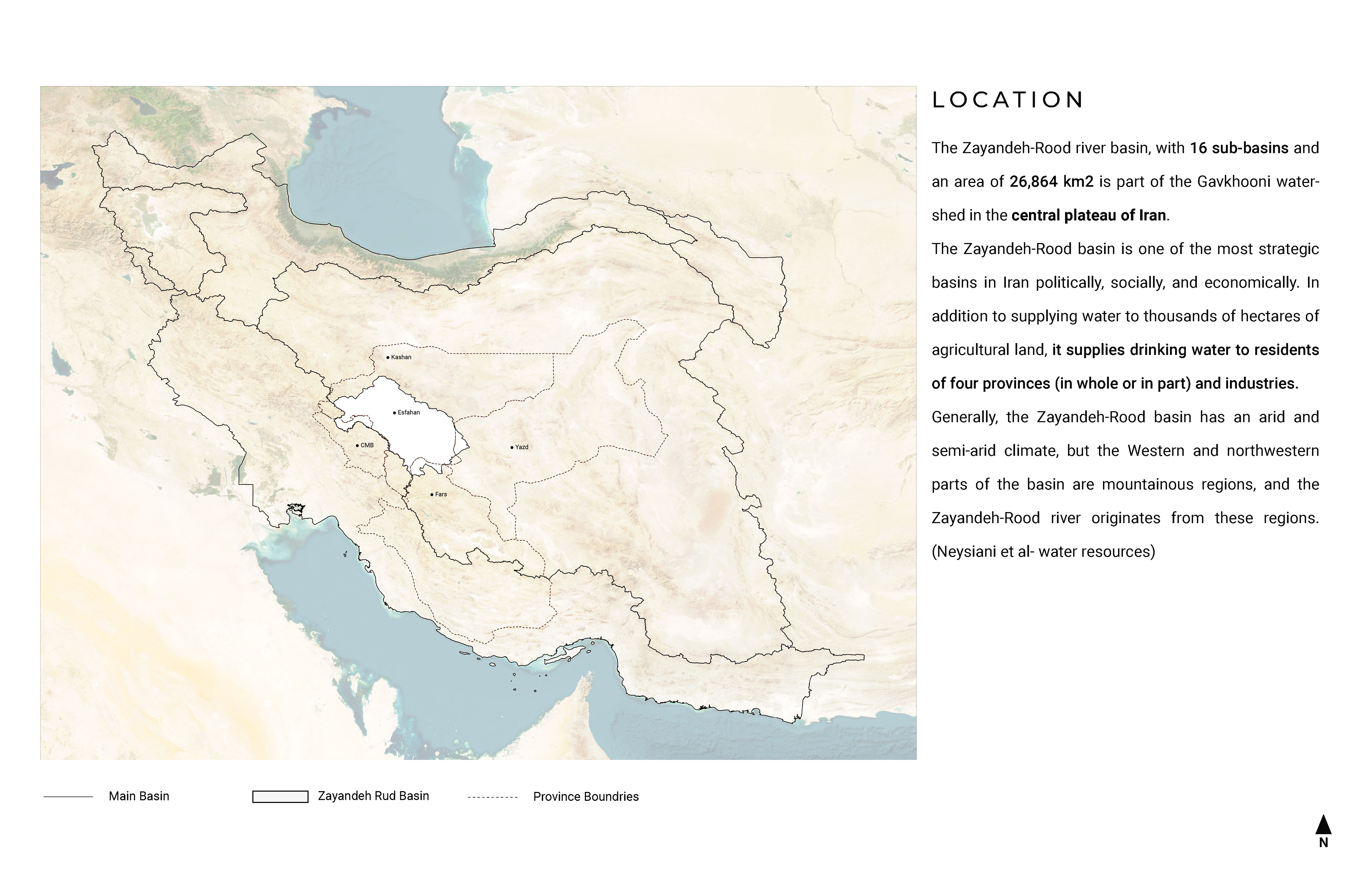
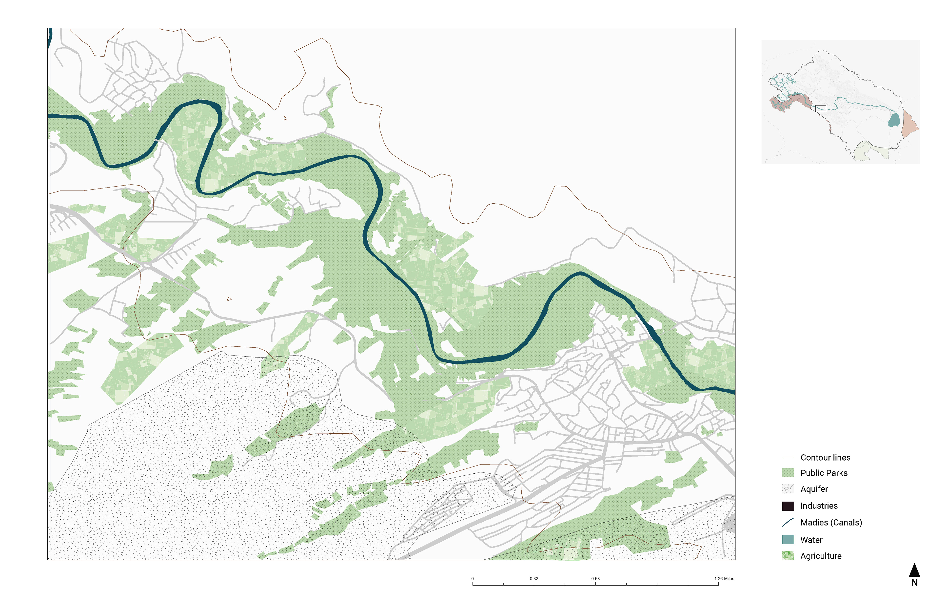
The Zayandeh Rud river basin, with 16 sub-basins and an area of 26,864 km2 is one of the most strategic basins in Iran politically, socially, and economically. (figure 01) In addition to supplying water to thousands of hectares of agricultural land, it supplies drinking water to residents of four provinces (in whole or in part) and industries. Generally, the Zayandeh-Rood basin has an arid and semi-arid climate, but the Western and northwestern parts of the basin are mountainous regions, and the Zayandeh-Rud River originates from these regions. 1 The catchment of the Zayandeh Rud (Farsi for ‘life-giving river ‘), is one of the most diverse regions in Iran: From the snow-covered Zagros Mountains, through wide floodplains and desert regions to the Gavkhuni wetland, the catchment is a special habitat. For centuries the river has attracted people, and the entire region is host to a uniquely diverse ecology.
Location
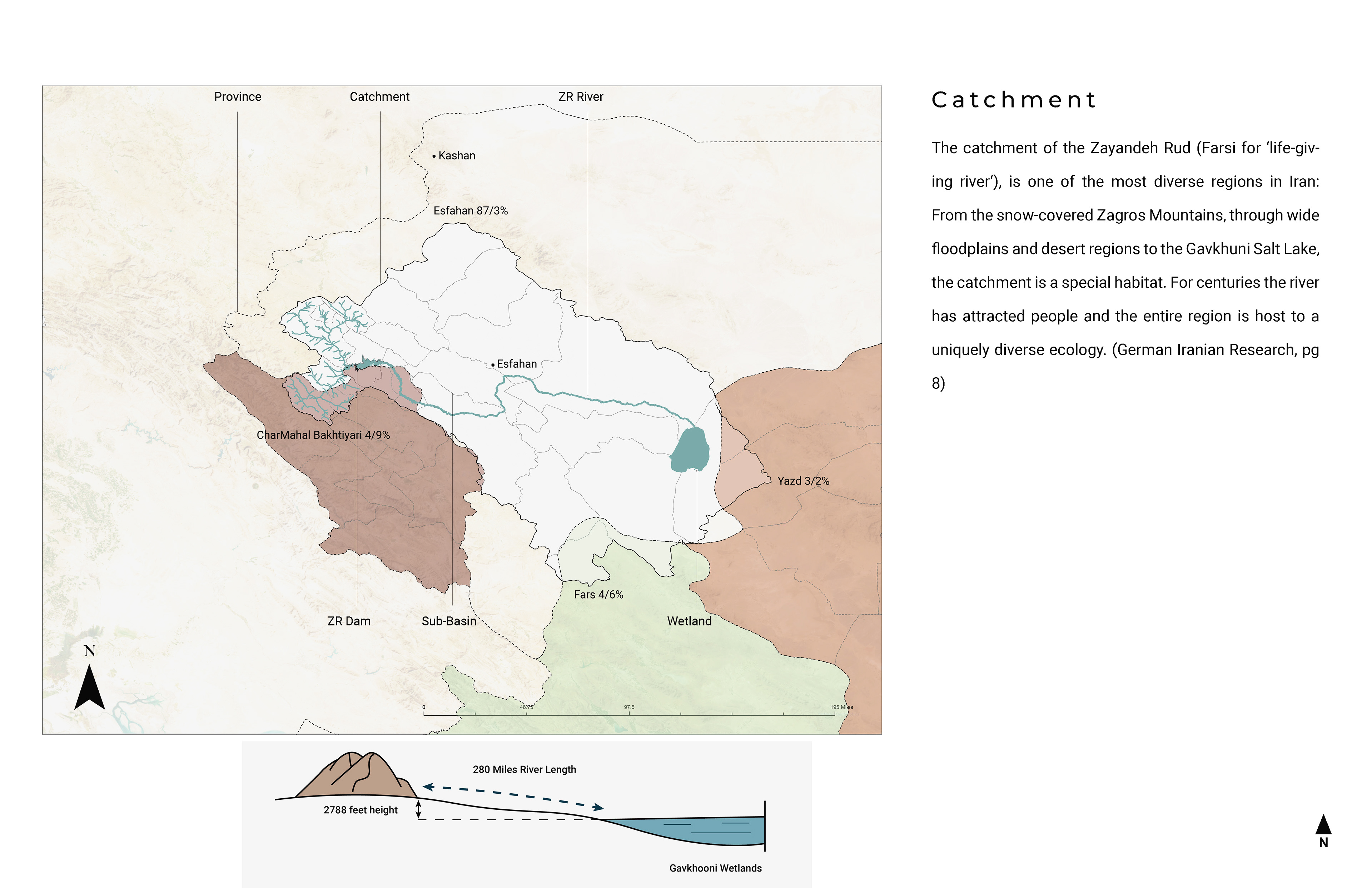
Catchment area
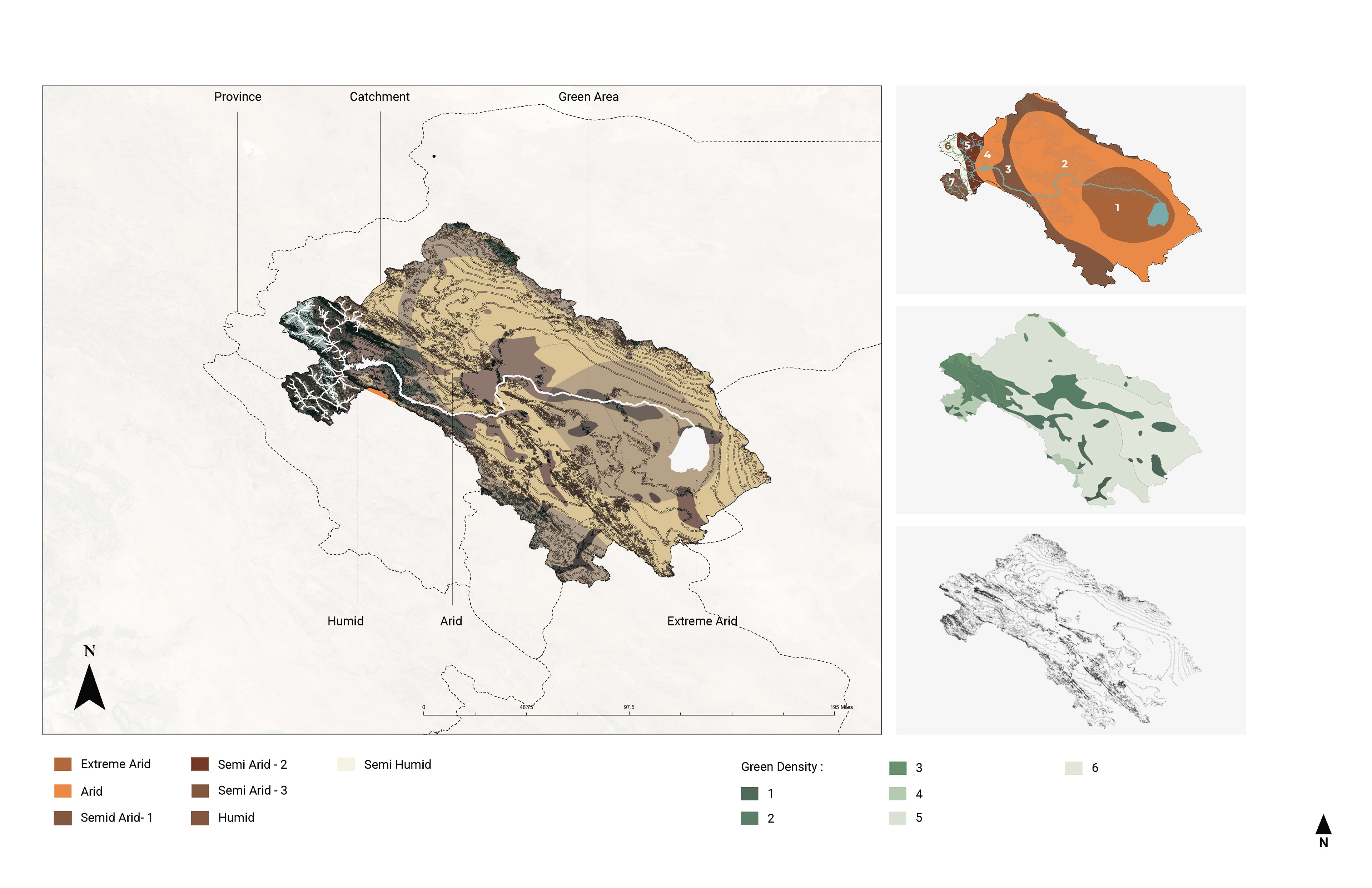
Climate, Landcover, and topography maps
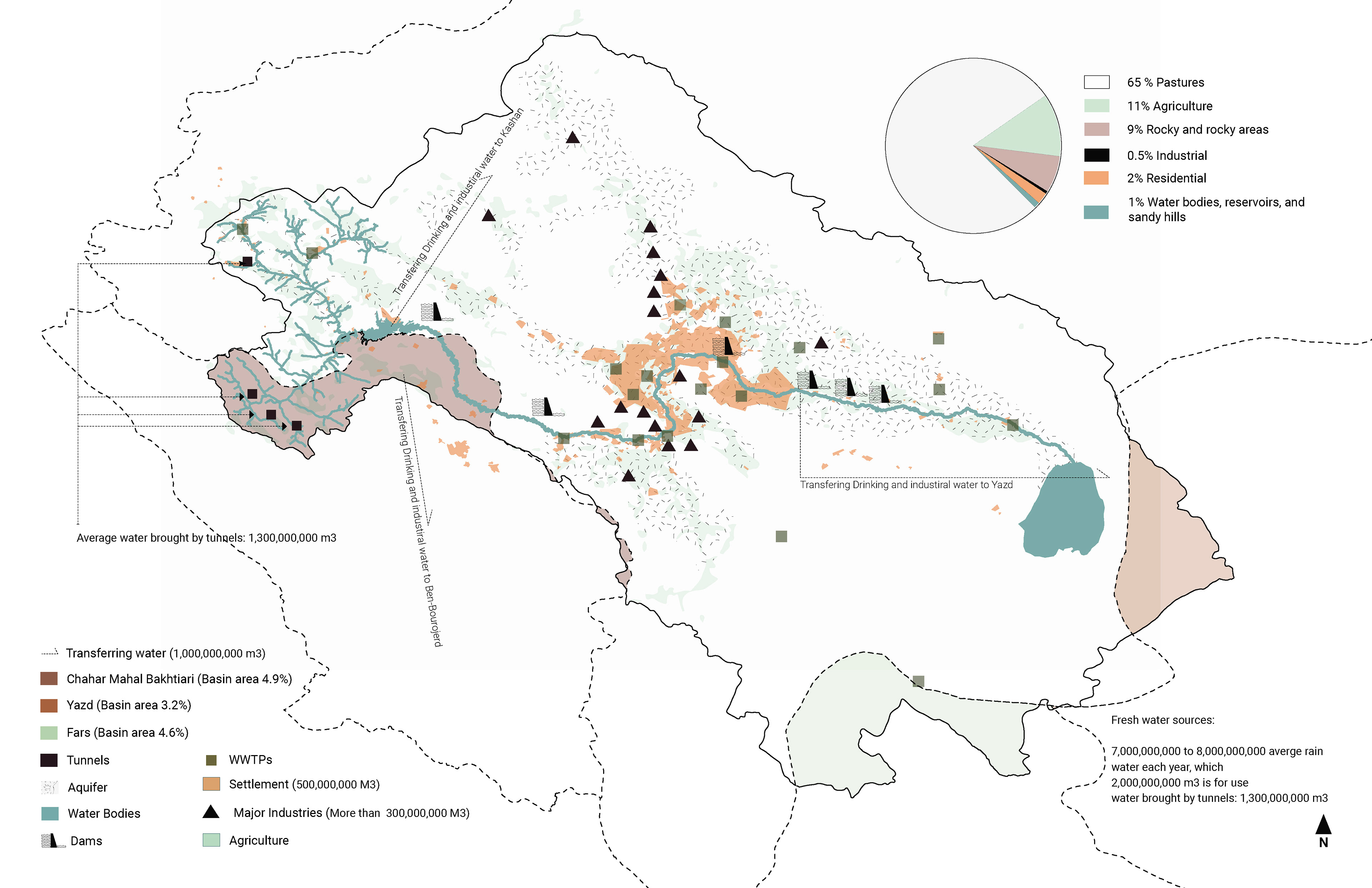
Water Usage, Land Usage
Esfahan City
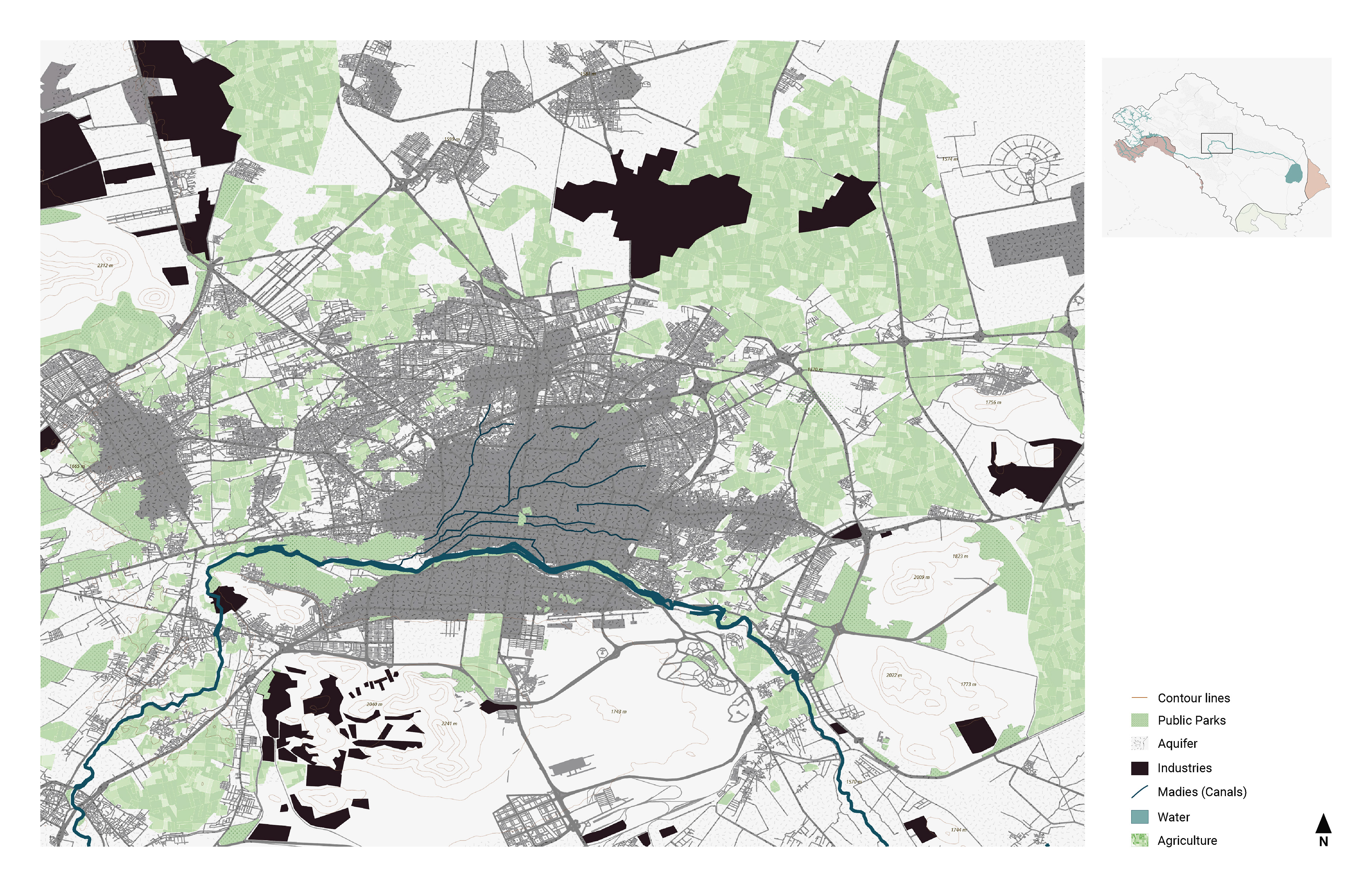
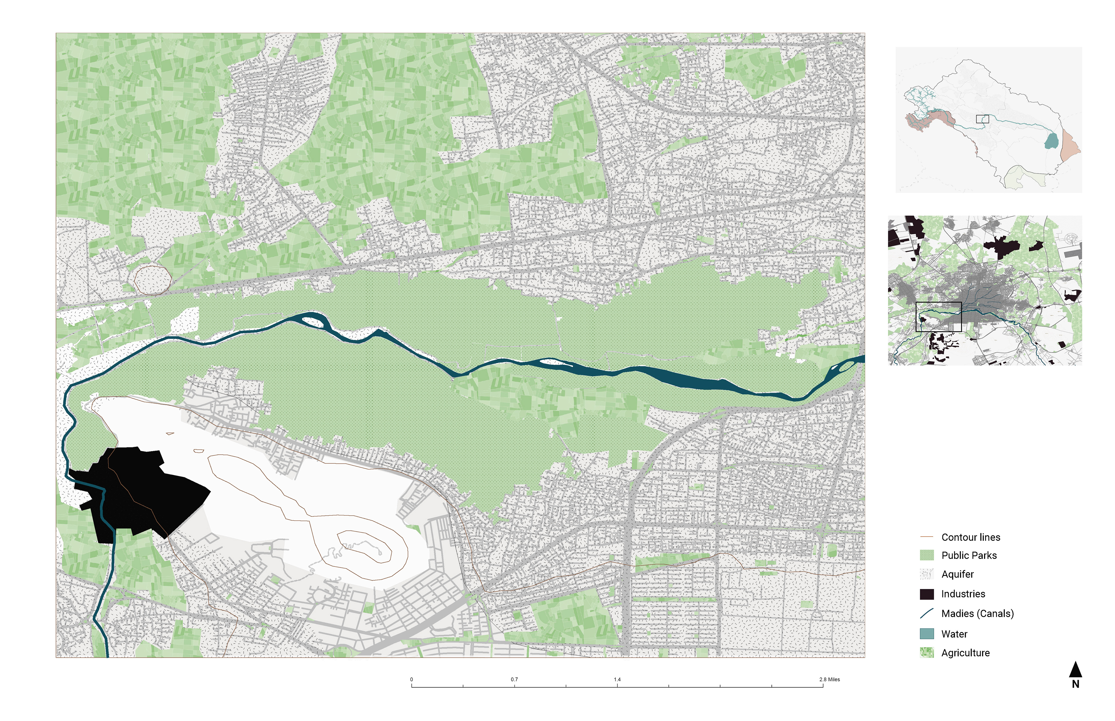
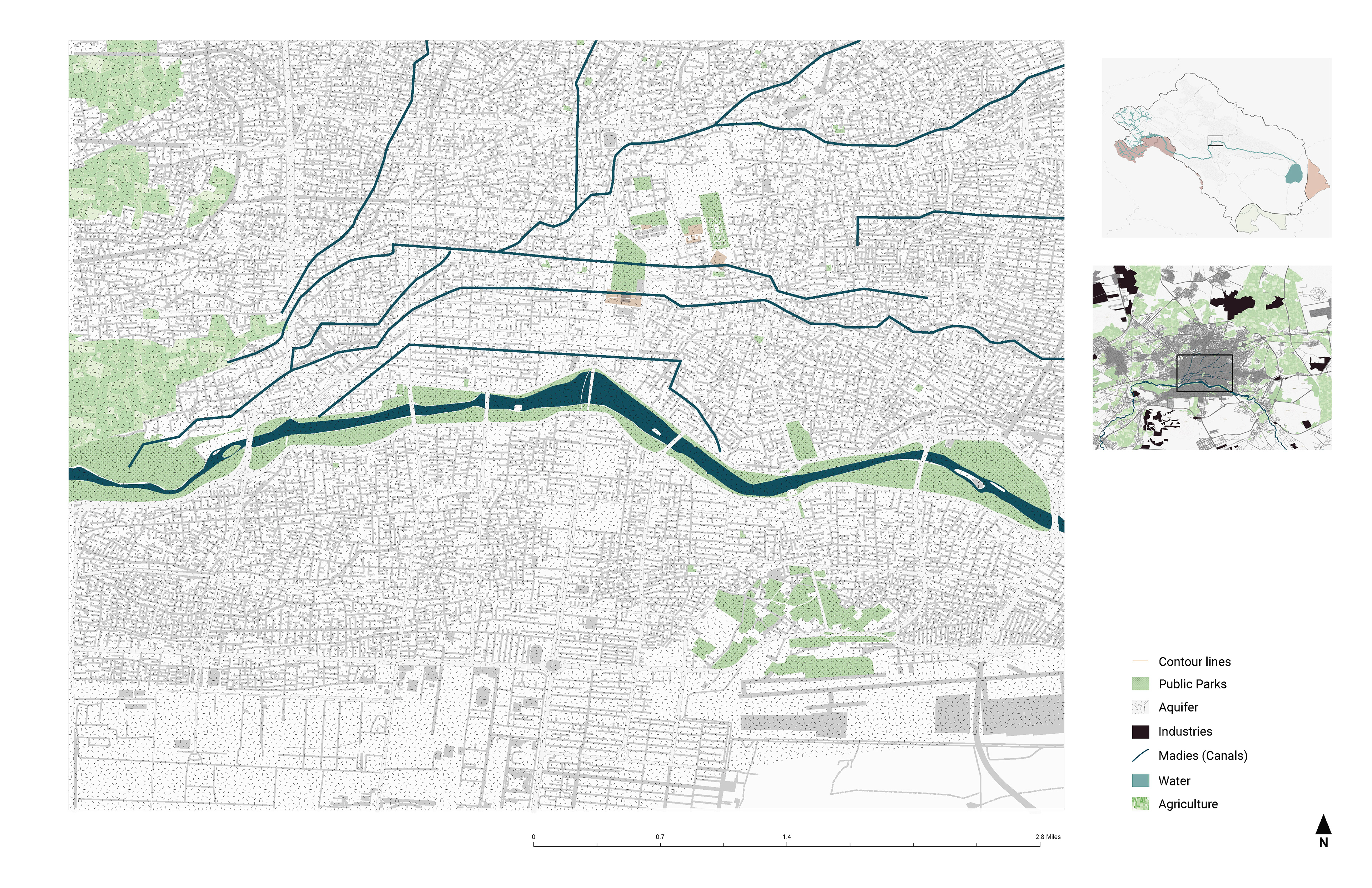
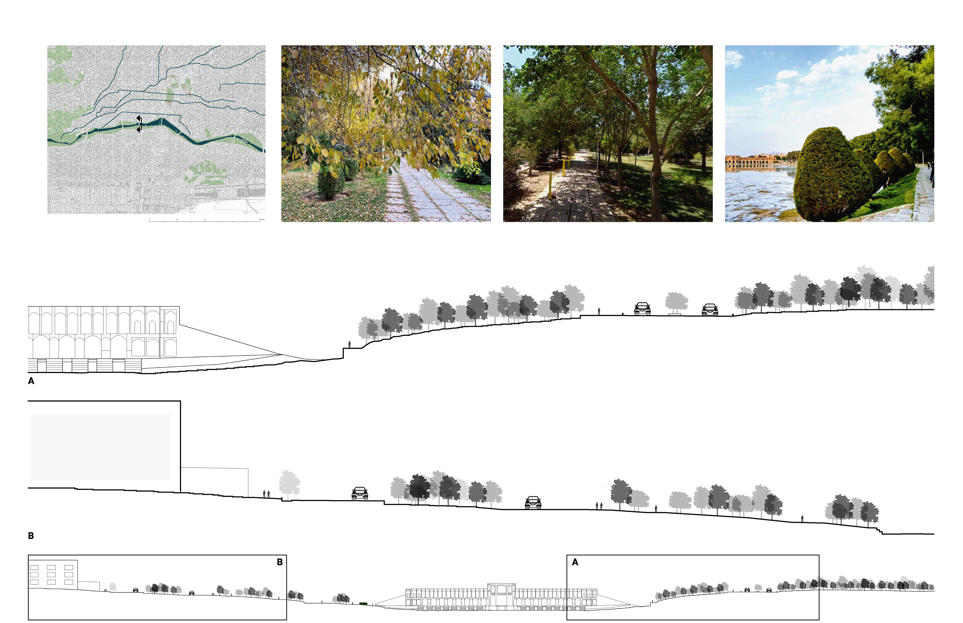
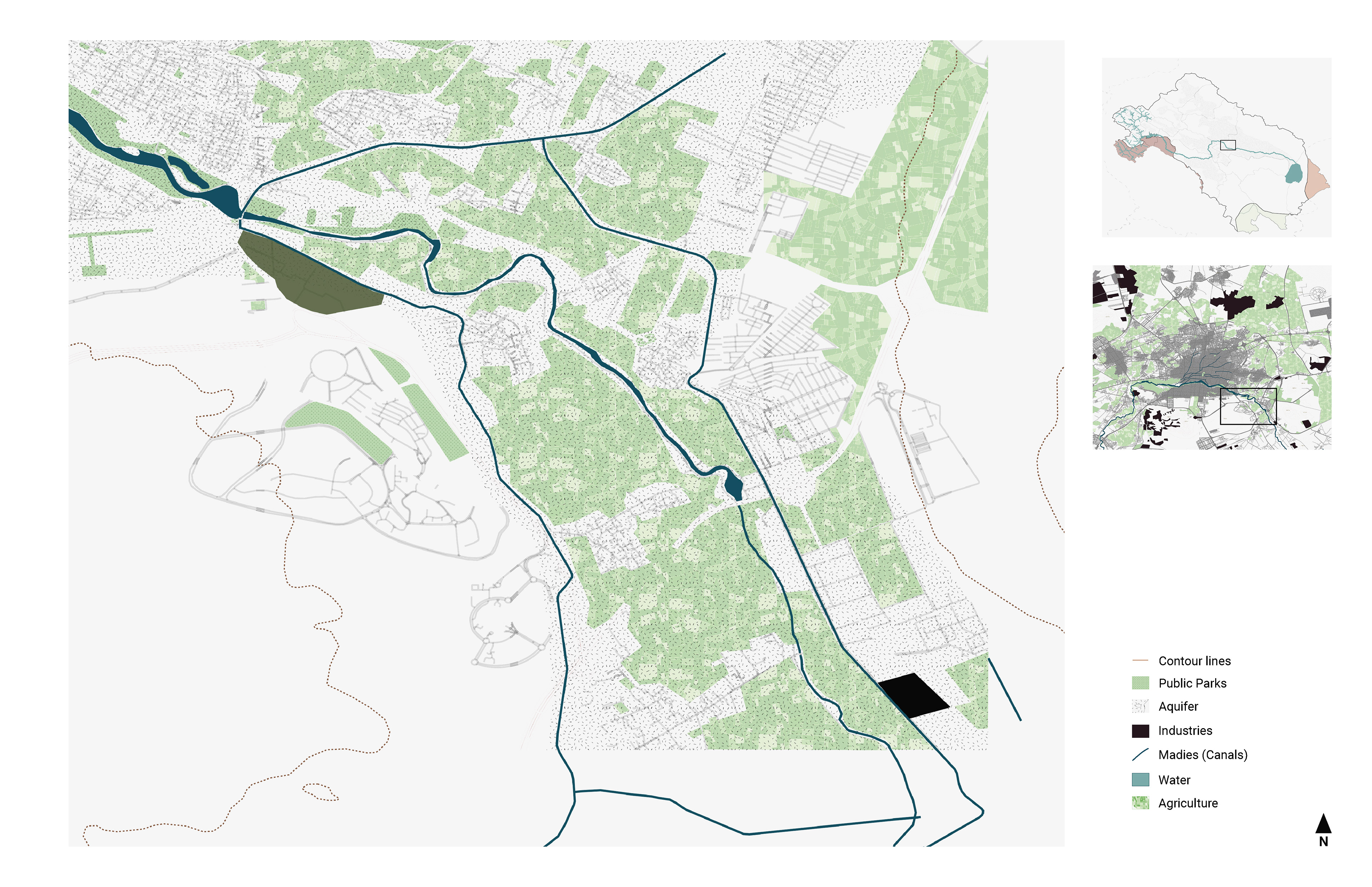
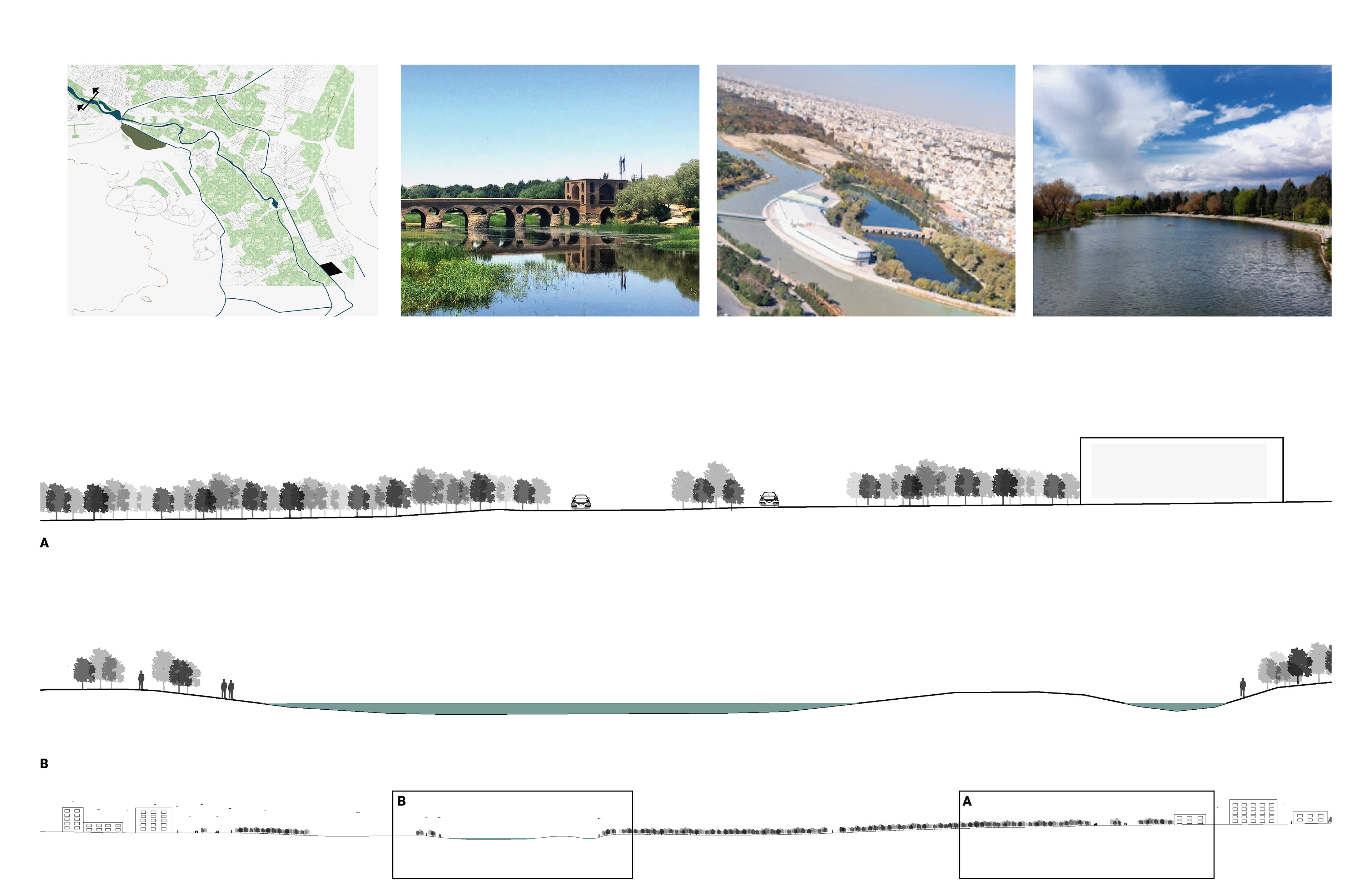
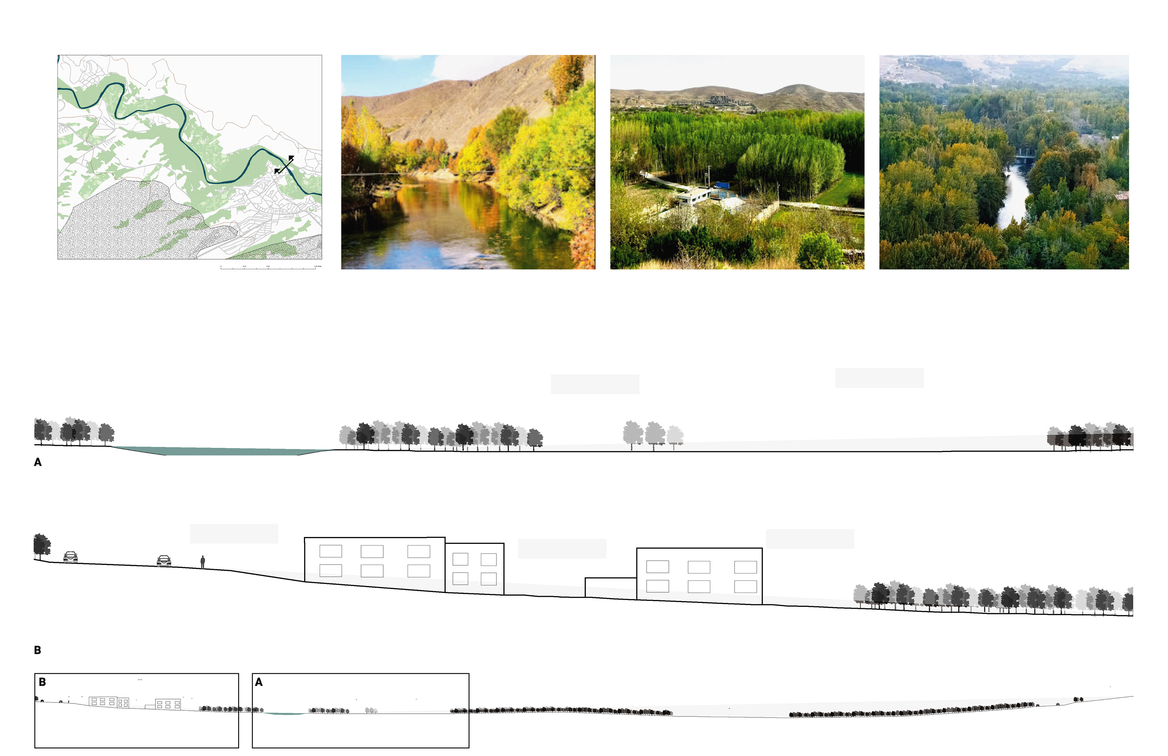
Zayanderood plays an important role in supplying drinking, industrial, and agricultural water resources in Isfahan province. The city also has a significant impact on the river's water quality, which means that more sustainable management of the city is crucial for the well-being of the river, the ecology of the area, and its people. Through analytical mapping, this phase of the research aimed to understand the overall impact of the city. Then, three random areas of the city—the west side (Najvan Park), the city center (Historical area and Chaharbagh Street ), and the east side (Pol-e-Shahrestan )—were mapped to compare these areas within the city. A fourth spot, a rural area (Madiseh village), was selected for comparison. The visual analysis highlighted several differences: 1. More greenery in the rural area and 2. Greater integration between the settlement, green spaces, and agricultural spaces


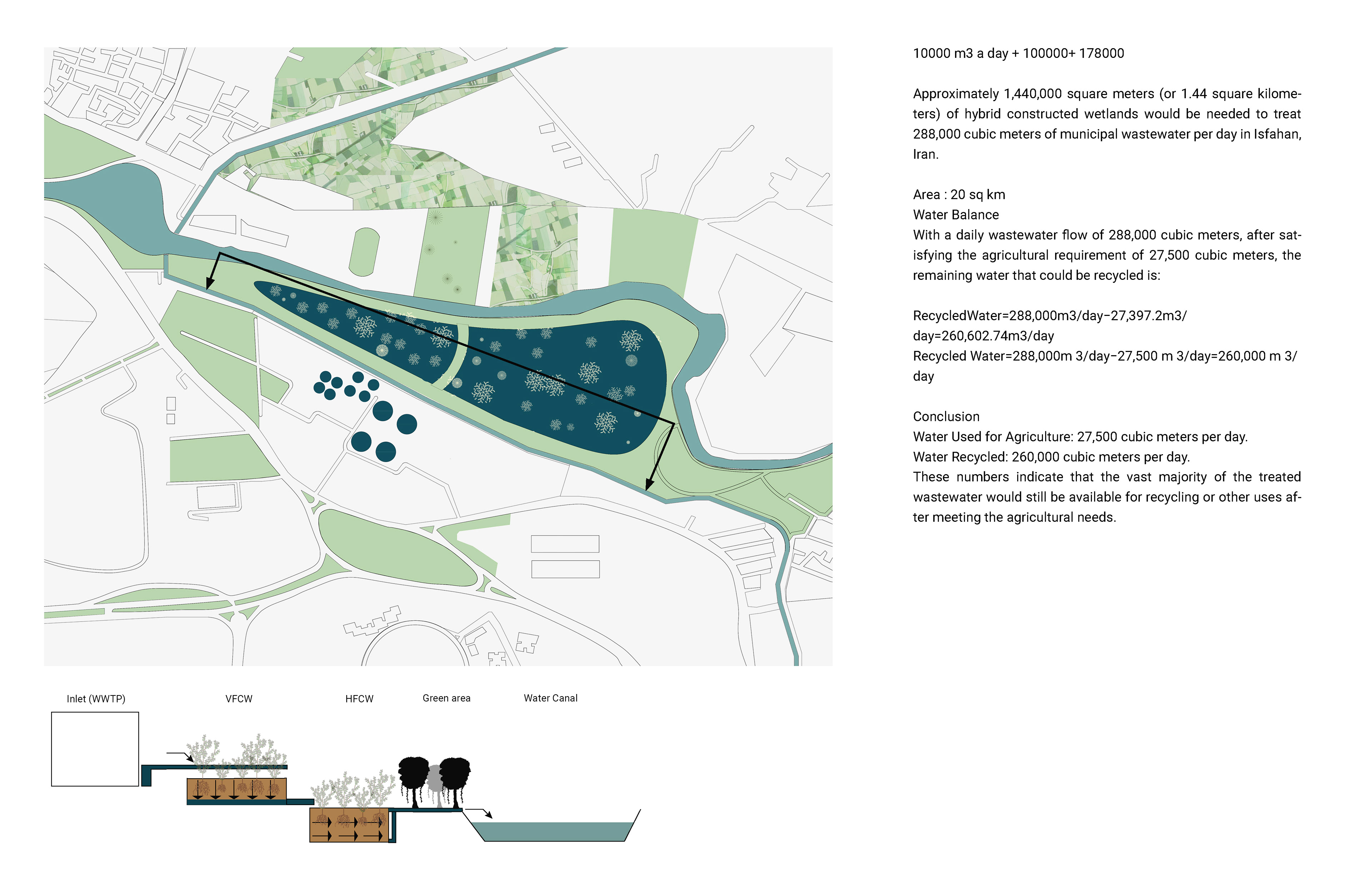
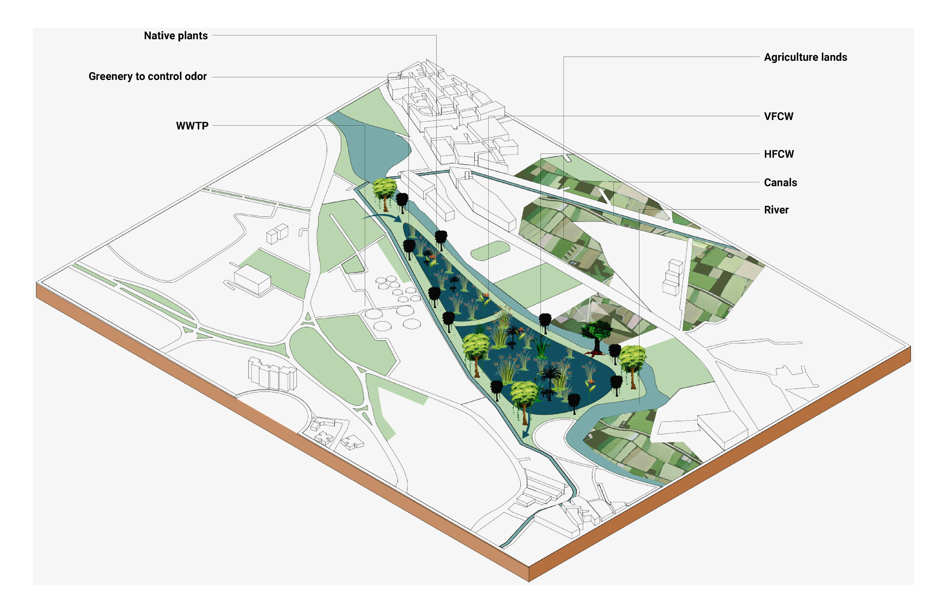
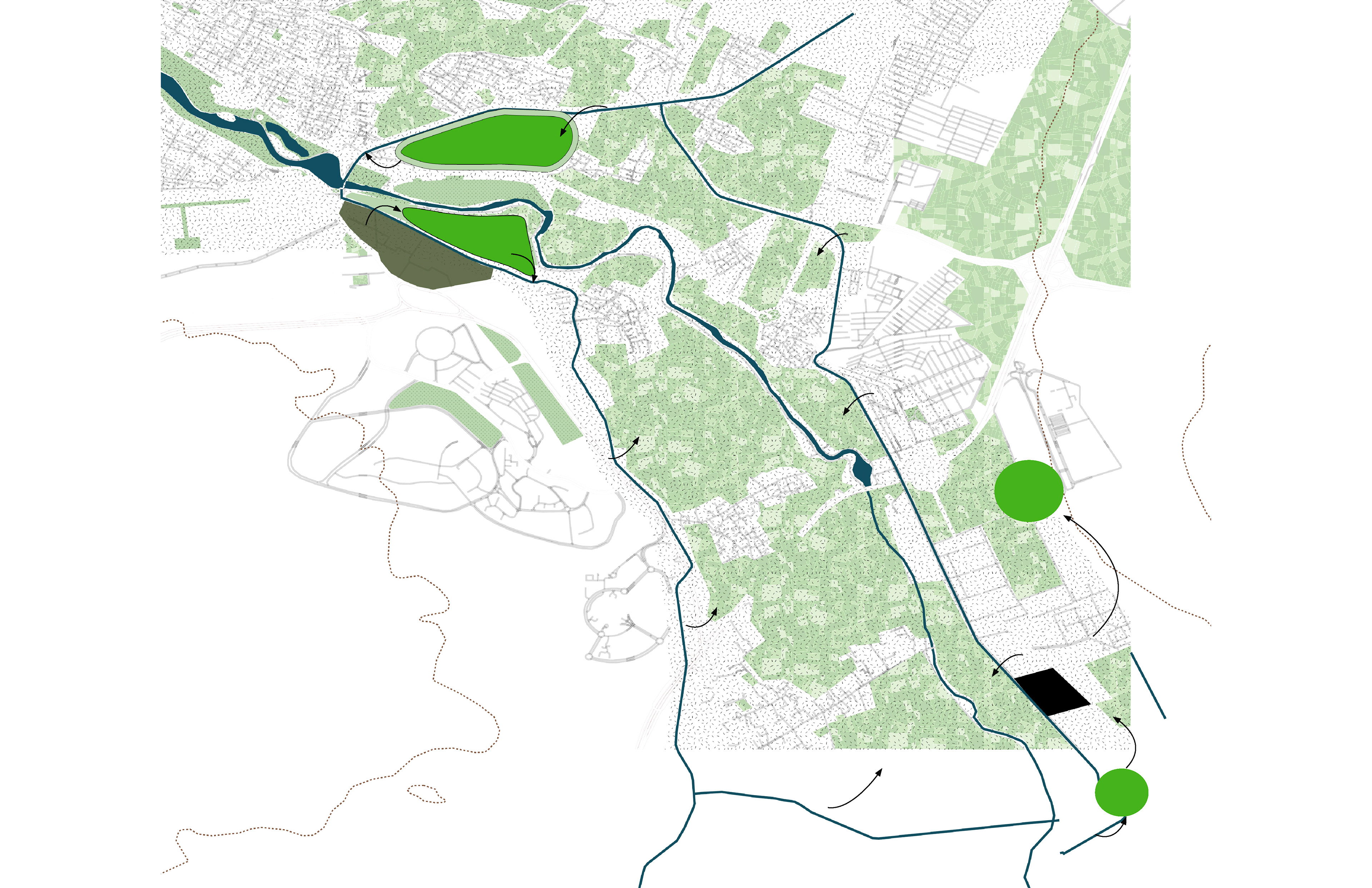
A conceptual design intervention is proposed to enhance the current facilities, requiring further detailed study. According to the EPA CW manual, selecting an appropriate location can significantly reduce costs. Site selection should consider factors such as land use and access, land availability, site topography, soil characteristics, environmental resources of the site and adjoining land, and potential impacts on neighbors. Ideally, the site should be located as close as possible to the source of the wastewater and downgradient to allow water movement through the system by gravity. Although a wetland can be adapted to nearly any site, construction costs may become prohibitively high if extensive earthmoving or expensive liners are needed. A well-suited site for a constructed wetland is one that is conveniently located near the wastewater source; thus, this site was chosen to be close to the WWTP facility. The wetland's shape should be influenced by the existing topography, geology, and land availability, while the number of cells depends on topography, hydrology, and water quality. On level sites, cells can be created with dikes. A site-sensitive design that integrates existing site features reduces the amount of earthmoving required and enhances the visual appeal of the site. Earth grading and shaping can blend newly created landforms with the existing landscape. Existing channels are used to follow the natural contours of the site. Various types of vegetation can be planted in and around a constructed wetland to reduce erosion, screen views, define spaces, control the microclimate, and manage traffic patterns. In this case, it can also be used for odor control and provide opportunities for educational outreach and recreation. The proposal involves receiving water from the WWTP and, after filtering it, releasing it into existing canals. These canals pass through the farmlands in the area, which cover approximately 14,500 hectares divided on both sides of the river. Each square meter of agricultural land requires an average of 1 cubic meter of water per year, resulting in a total water usage of about 27,500 cubic meters per day for irrigation (calculation: 14,500 hectares×1 cubic meter per year/365 days14,500 hectares×1 cubic meter per year/365 days). Agricultural lands can filter the water through a newly constructed wetland, though details still need to be studied. Industries located further down the canals can use this water, but they need to have their own CW designed and return it to the agricultural lands on the other side of the river. This cycle helps in bringing back the water to the rest of the farmlands and treating it just before it reaches the other side of the river to the canal.