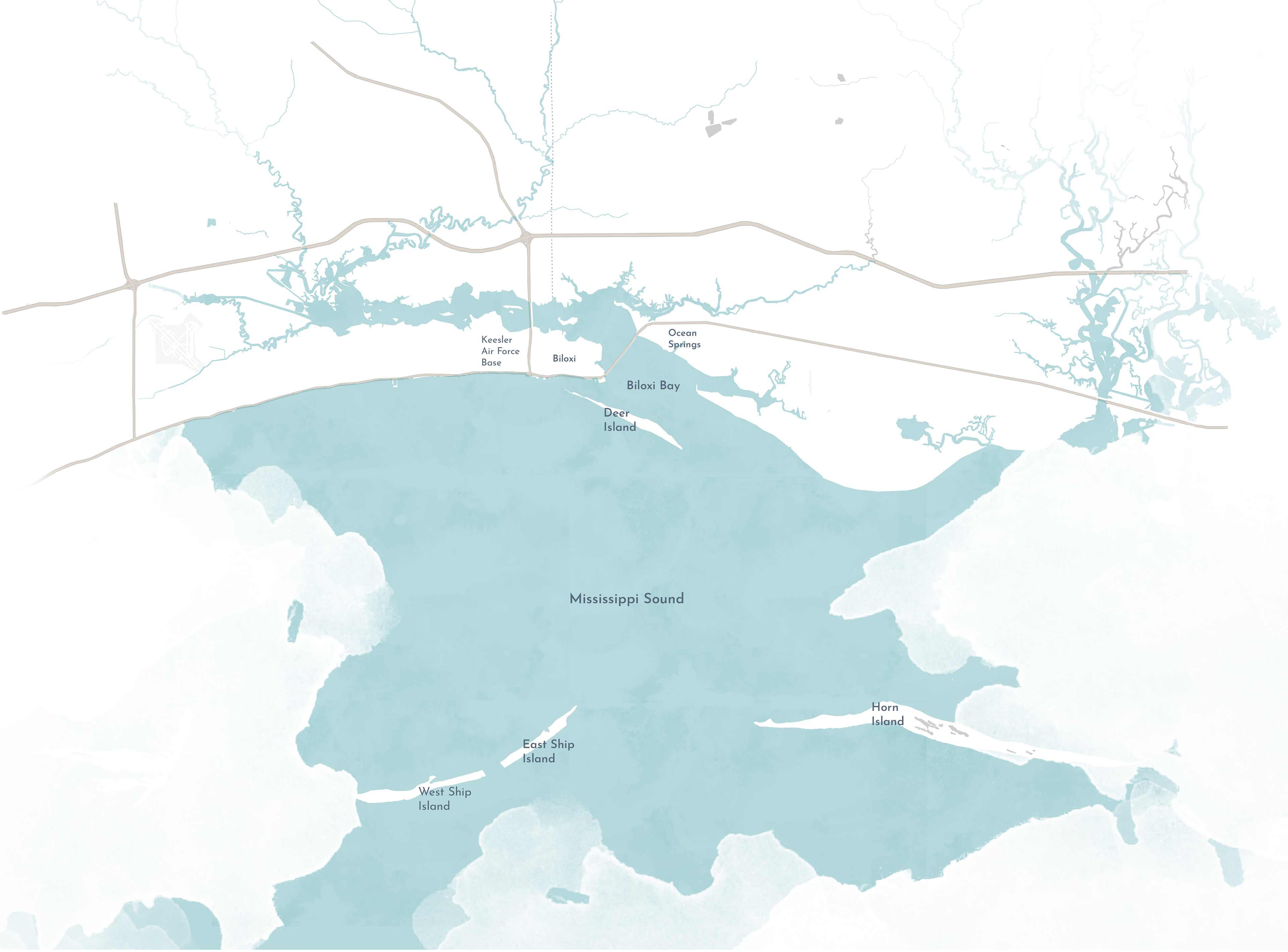
Mississippi has 82 counties, and some of them are located along the Gulf Coast. The Gulf Coast region
of Mississippi is home to the Mississippi Sound and includes several barrier islands as well. Rivers draining
the region, including the Biloxi River and Tchoutacabouffa River, carry high sediment loads (Altsman &
DeMay, 2007). Biloxi has a population of 44,547 with a median age of 27-45. The populous areas regularly
experience flooding, are prone to hurricanes and other tropical storms, and have low-lying areas that
experience storm surges.
Over the last 50 years, Mississippi has lost ~2,100 acres of vegetated coastal wetlands. The issues that exist in the area are shoreline erosion, habitat loss, nutrient pollution, and derelict recreation facilities from past storms. This project site area focuses on the 77-acre Hiller Park and 1.9 miles of shoreline. Previous studies have reviewed the area’s salinity, water depth, wave energy, and habitat loss but gaps exist around how to capture sediment and rebuild land to recapture the area that has been lost to coastal erosion over time.
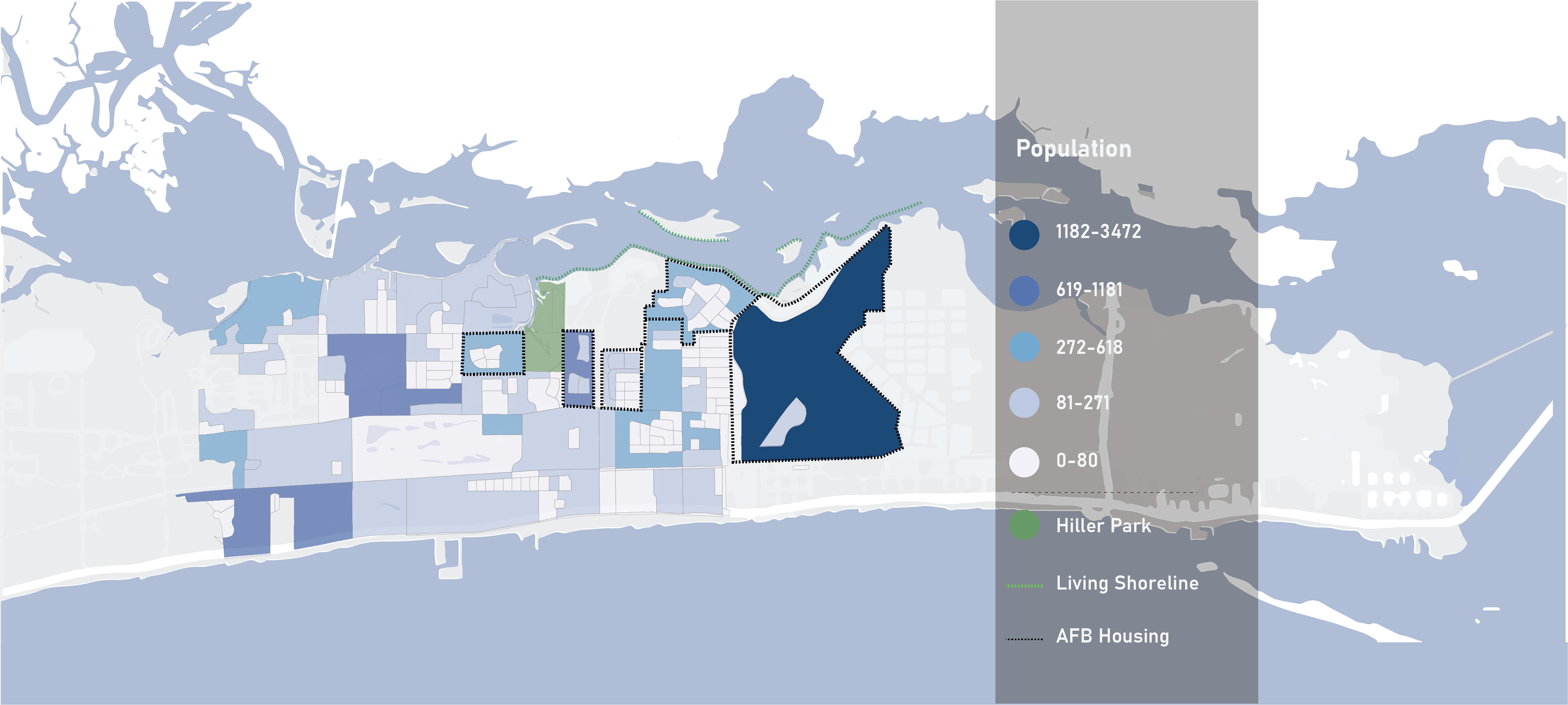
The Keesler Air Force Base, Veterans Housing, and other Military Housing are among the highest concentrations of population in West Biloxi. Changing climate conditions among the population were reviewed such as flood zones and sea level rise.
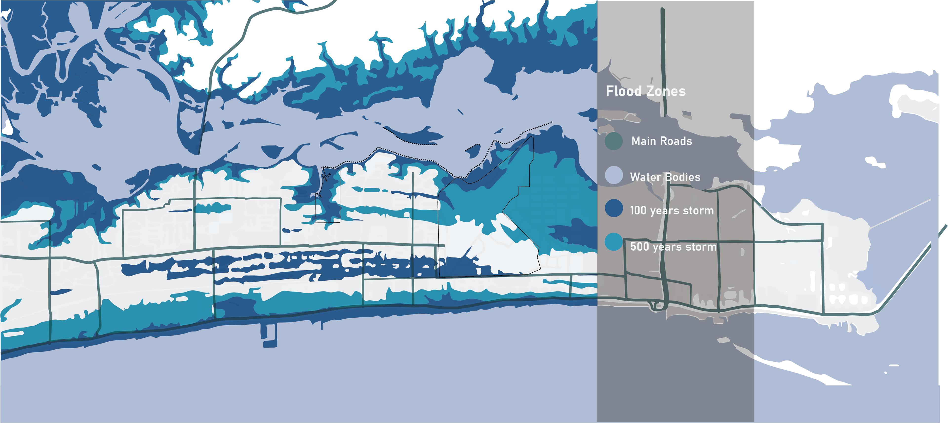
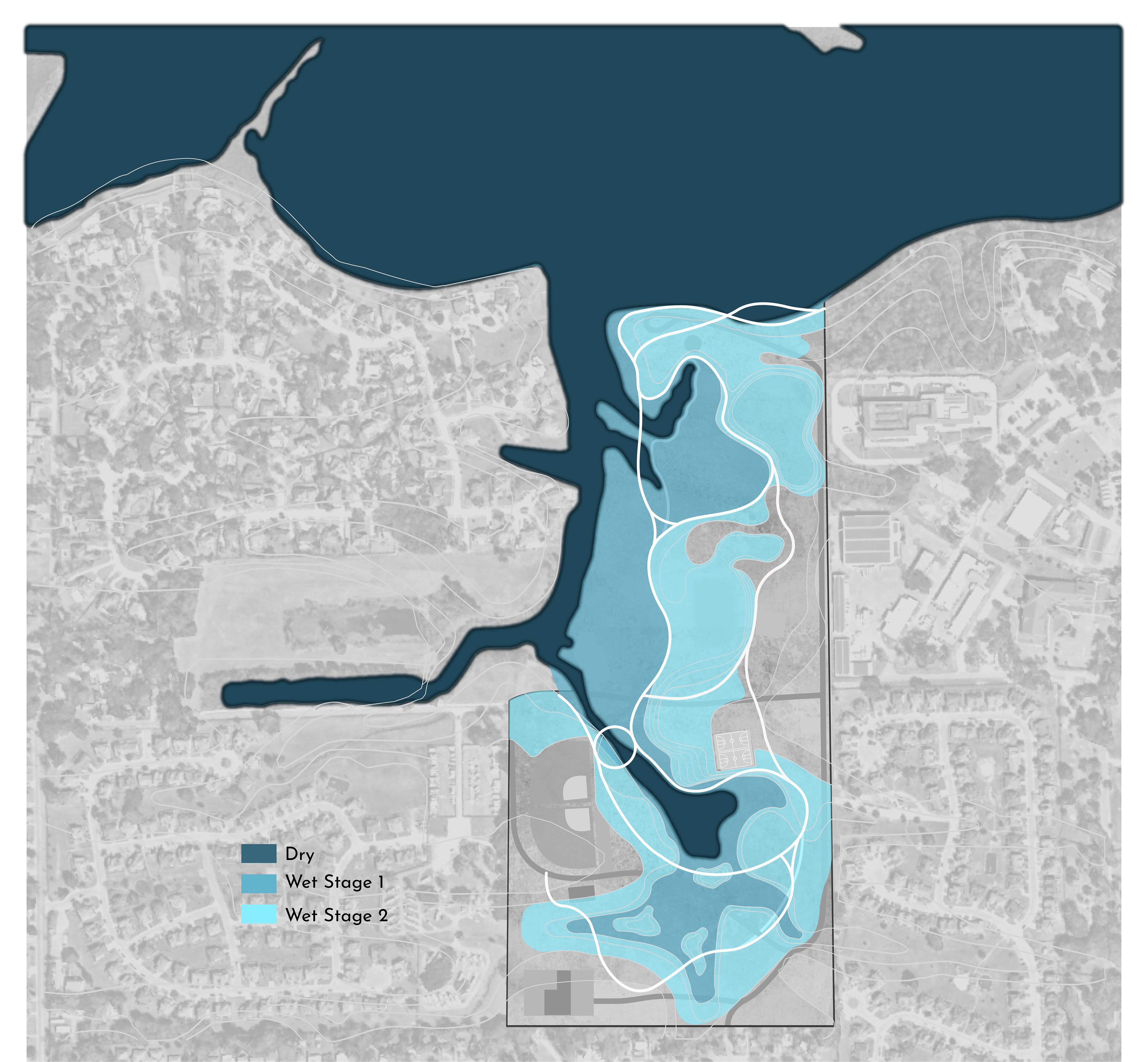
The current flood maps show that for a 100-year storm the majority of Hiller Park and Keesler AFB are flooded, and that water could flow into the surrounding neighborhoods.
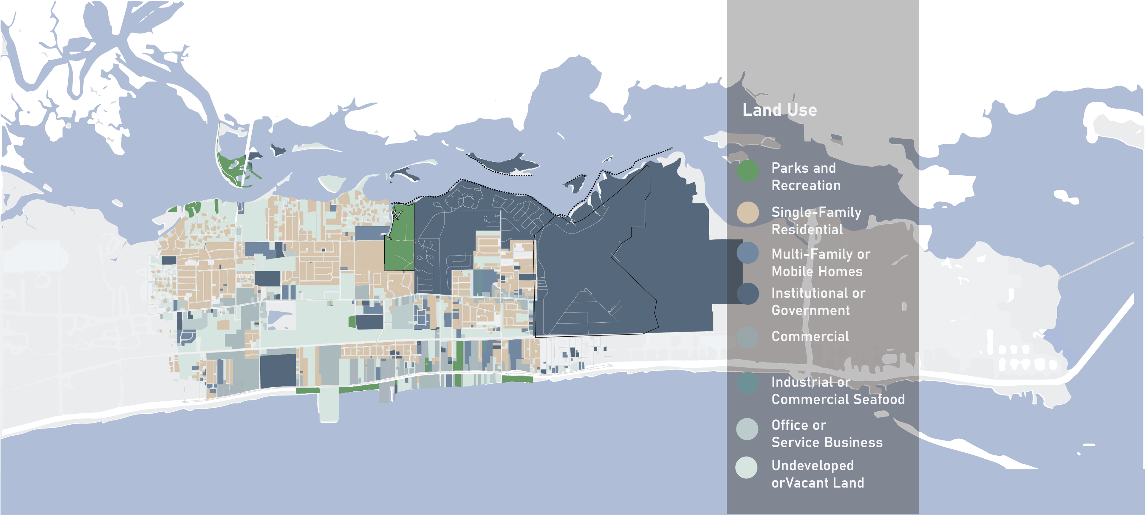
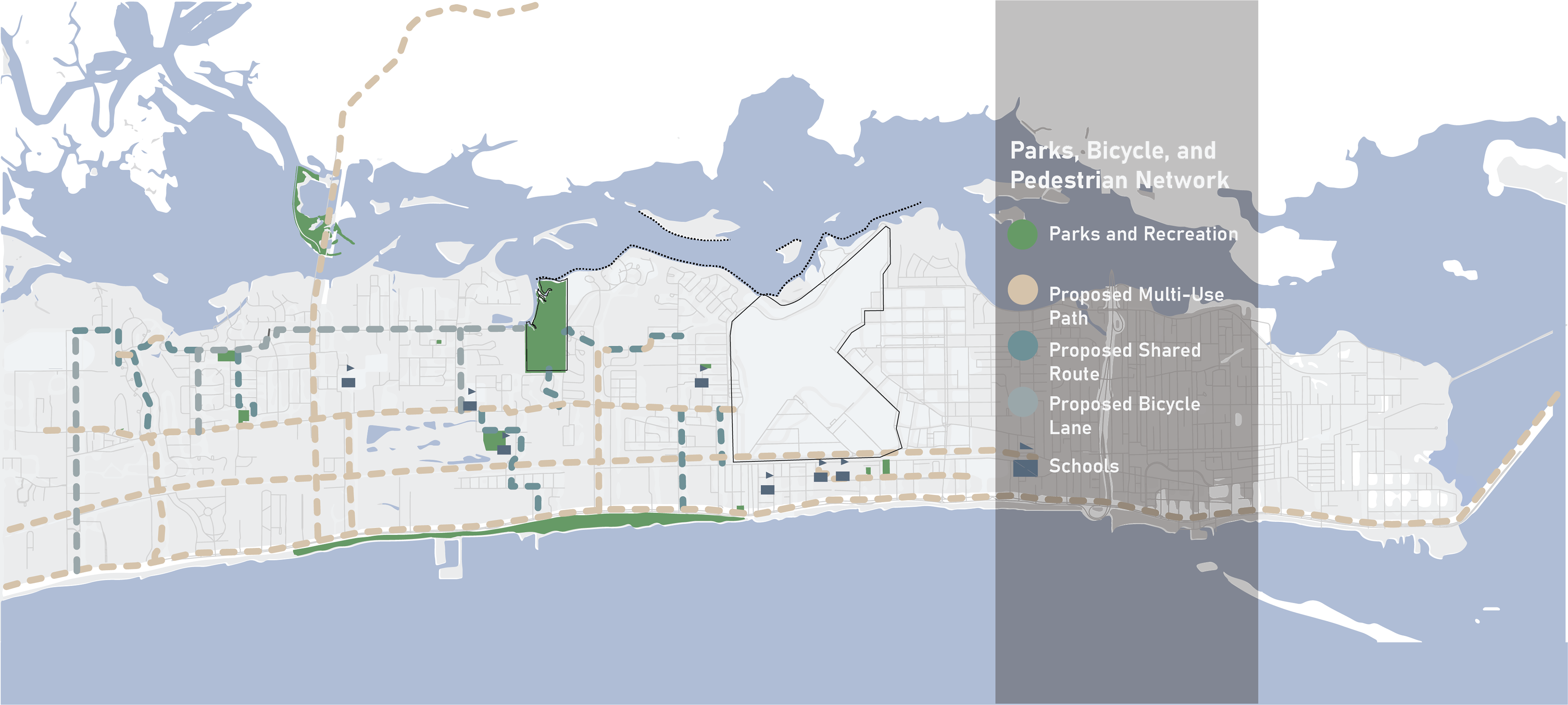
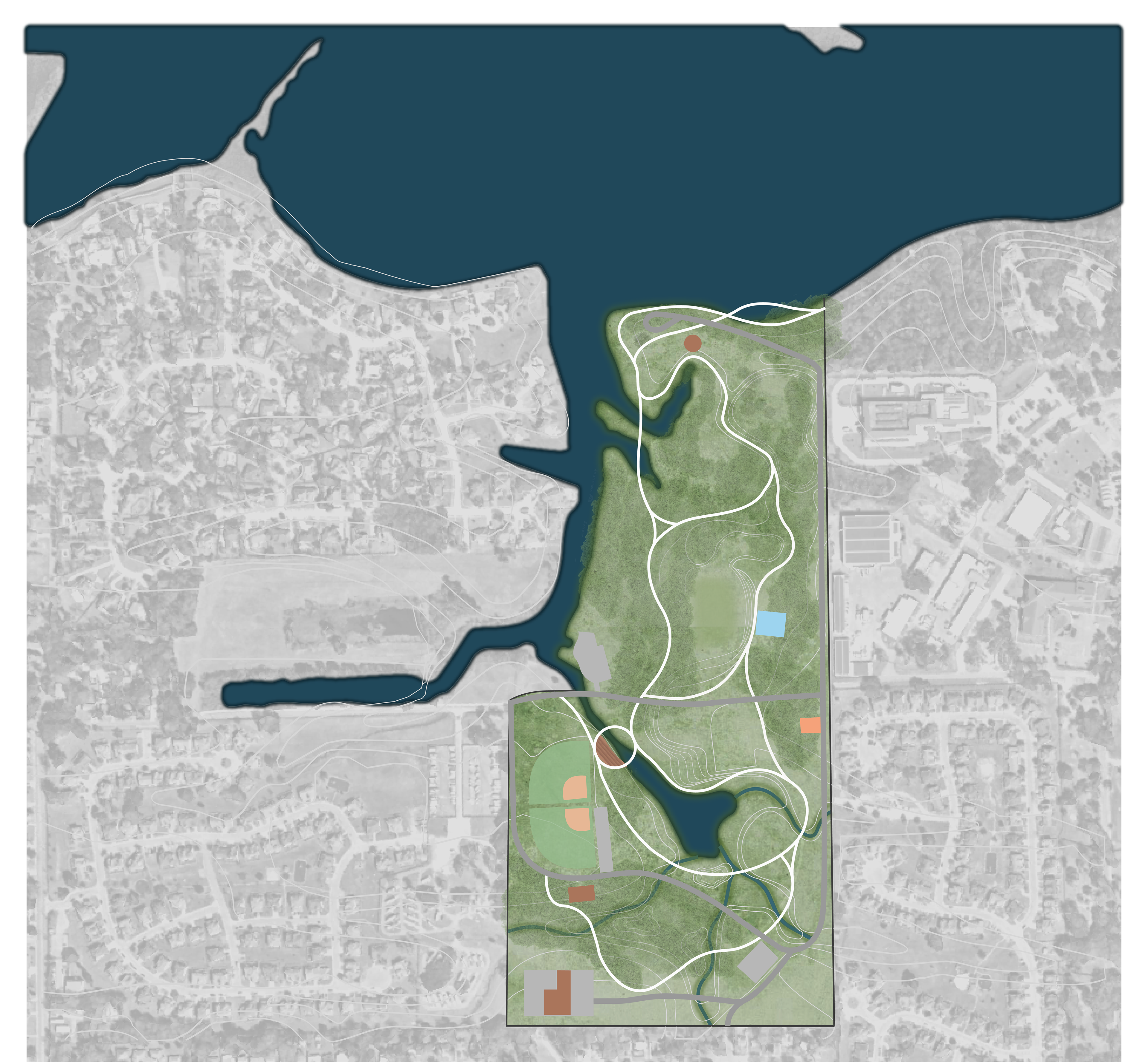
The way land is used near the park and the shoreline along with traffic conditions and pedestrian networks, delivered key insights that supported functional design options. For example, Hiller Park is the largest land mass of parks and recreation in West Biloxi being a third of all parks available and being interconnected through shared used paths to major arterial roads that feature goods, services, and retail.
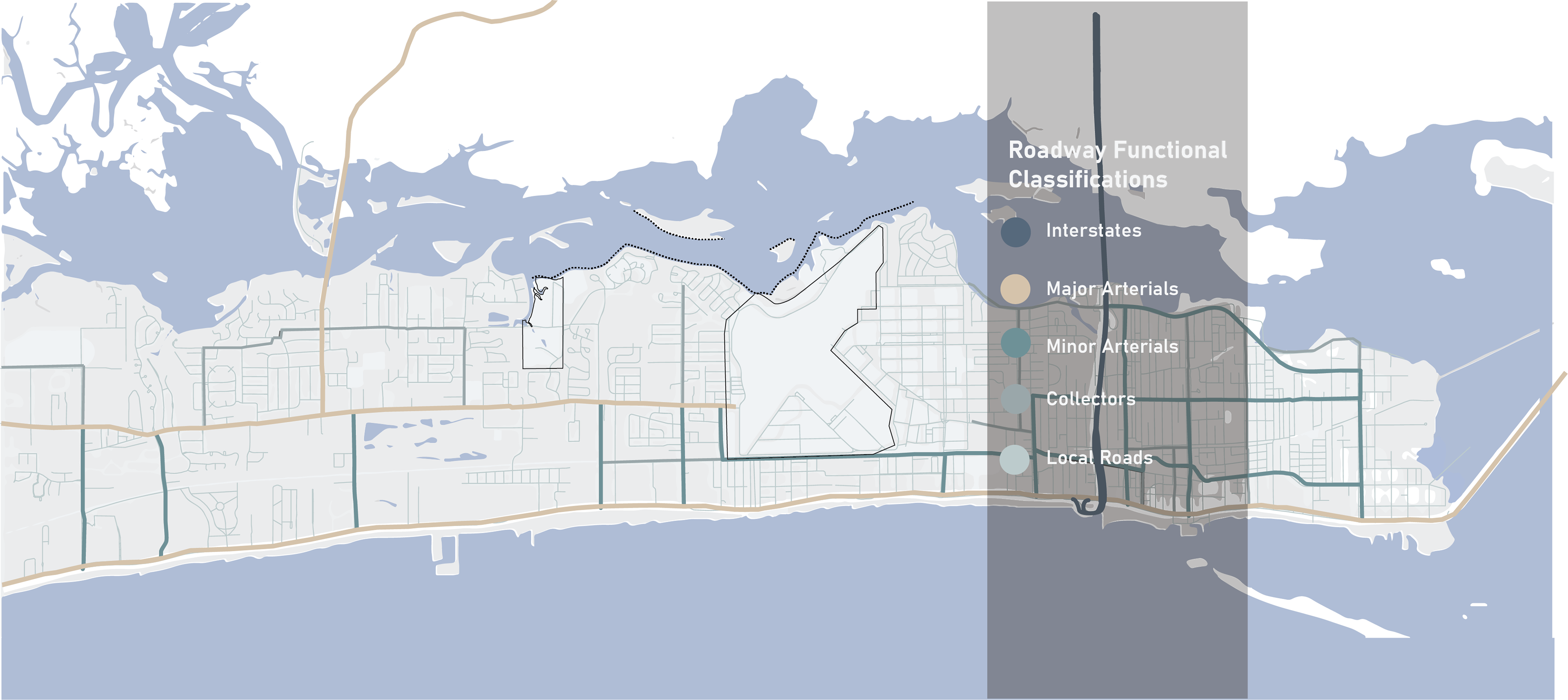
The Biloxi comprehensive plan contemplates various strategies that aim to improve the condition of the infrastructure network that links community assets together. Pass Road, Atkinson Road, and Veterans Ave are key roadways that high amounts of traffic and therefore have become candidates for proposed complete street streetscape interventions. Plans for this area will increase the amount of linear feet of protected bike lanes and shared use paths ultimately connecting more users to the park and the shoreline.
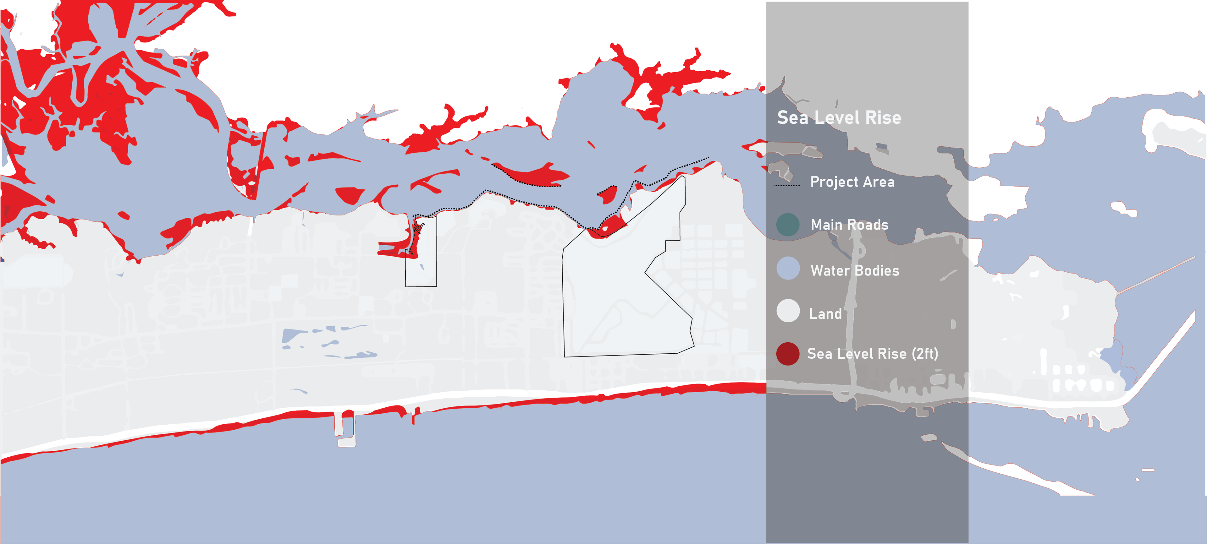
Sea level rise could make these sites even more vulnerable to storms in the future as storms continue to become more severe due to climate change. This compounding effect could greatly impact the resiliency of Keesler AFB and the surrounding neighborhoods.
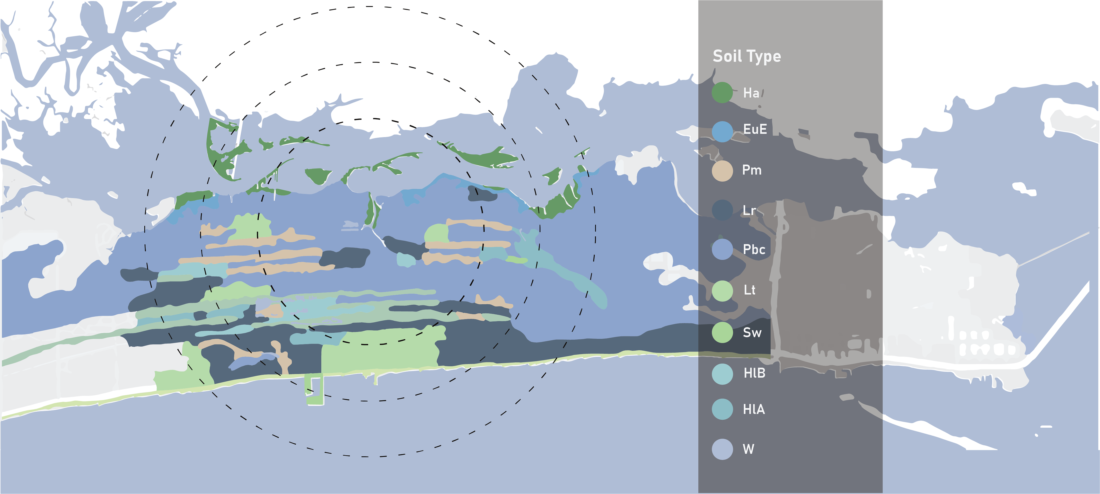
With majority developed land at medium intensity, substantial tree canopy, and well-drained soil, the environmental conditions of this project areas delivers a conditional assessment for ecological possibilities. PbC – Thermic, coated Aquic Quartzipsomments --> Moderately well drained Ha – Euic, thermic Typic Sulfihemists --> Poorly drained Lr – Thermic, coated Typic Quartzipsomments --> Very well drained EuE – Loamy, Siliceous, subactive, thermic Grossaremic Paleudults --> Very well drained
Hiller Park is a crucial recreation spot in Biloxi due to the park encompassing 31% of the total park land on the west side of the city. According to the American Planning Association, one acre of park and recreation is recommended for every 100 people. (American Planning Association, 1965) There are 21,433 people within a two-mile radius of Hiller Park, prompting a recommendation of 214 acres of parkland. Currently, 247.94 acres of park and recreation support the population, with Hiller Park representing an enormous land mass of park and recreation at 77.7 acres.
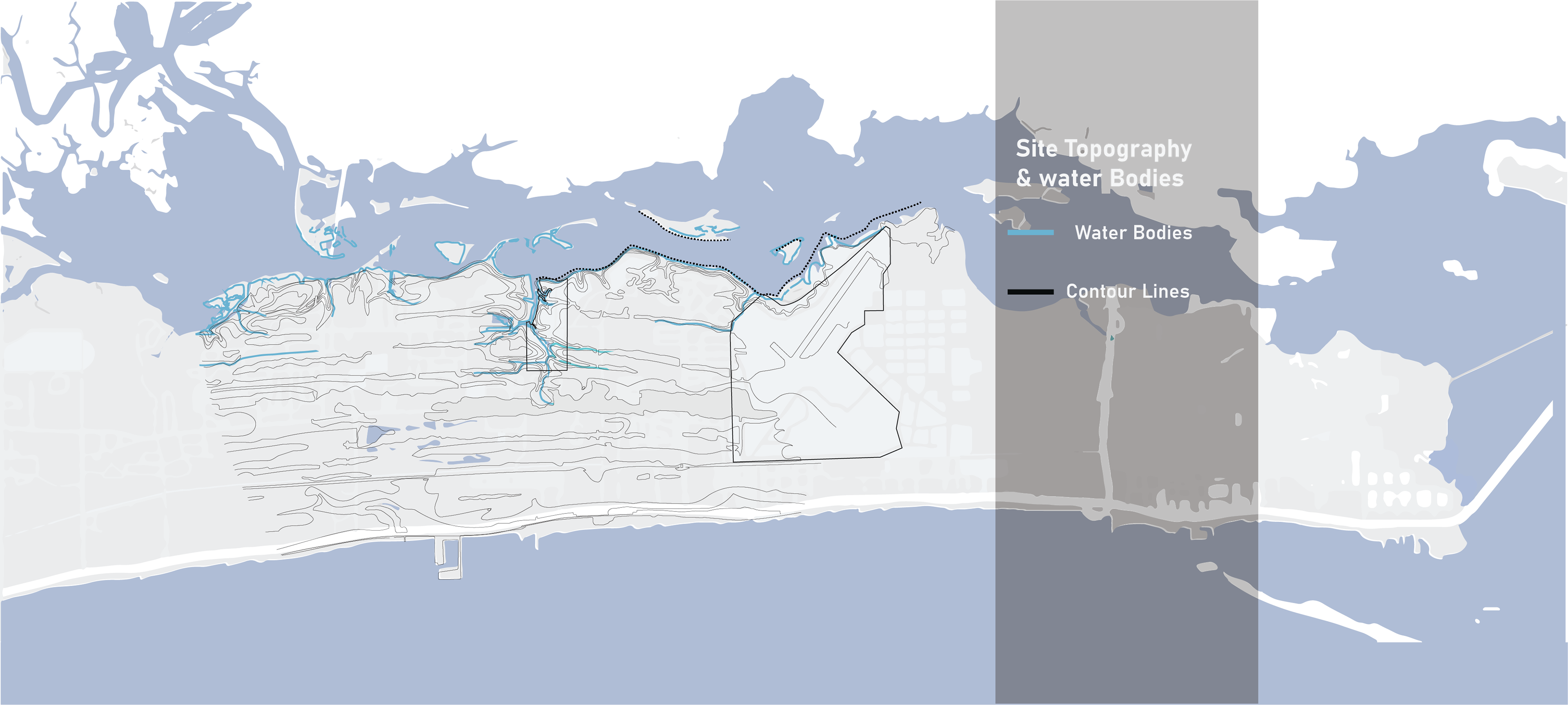
This map depicts the topography and water bodies in the site area. The highest elevation in the project area is VA Hospital, while the lowest and the most vulnerable site is Keesler AFB.
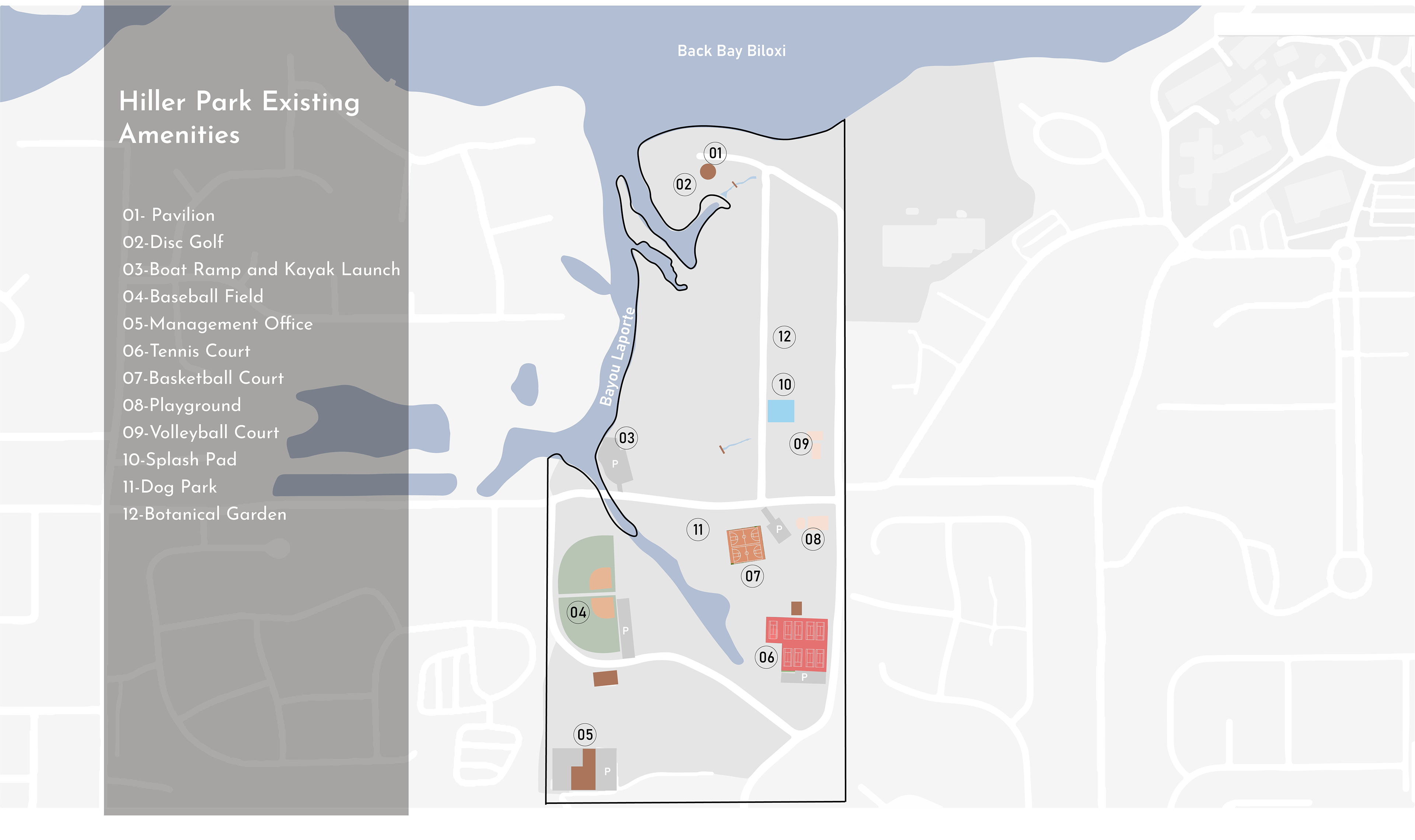
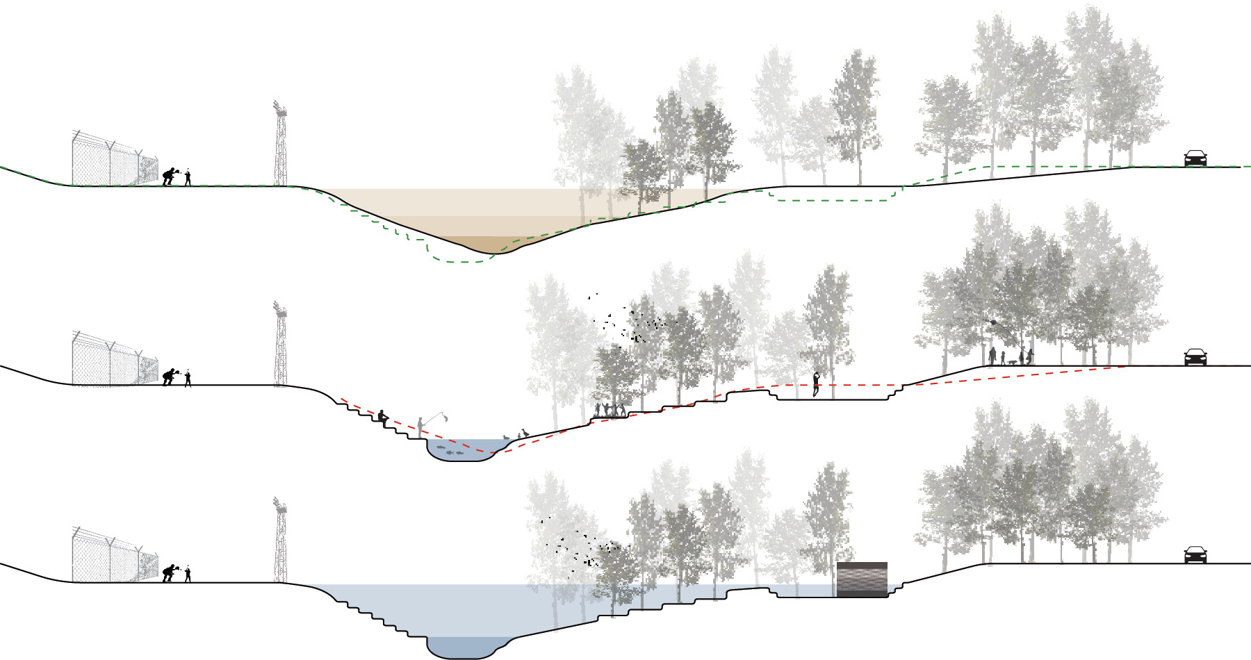
Hiller Park is a vital recreation spot for Biloxi and has some existing amenities. Even though some are derelict, the team aims to make them a better place. However, the giant Tennis court that is not used for a long time and takes a large amount of impervious surfaces is replaced by a dried pond, which can be a play field during the dried stage.

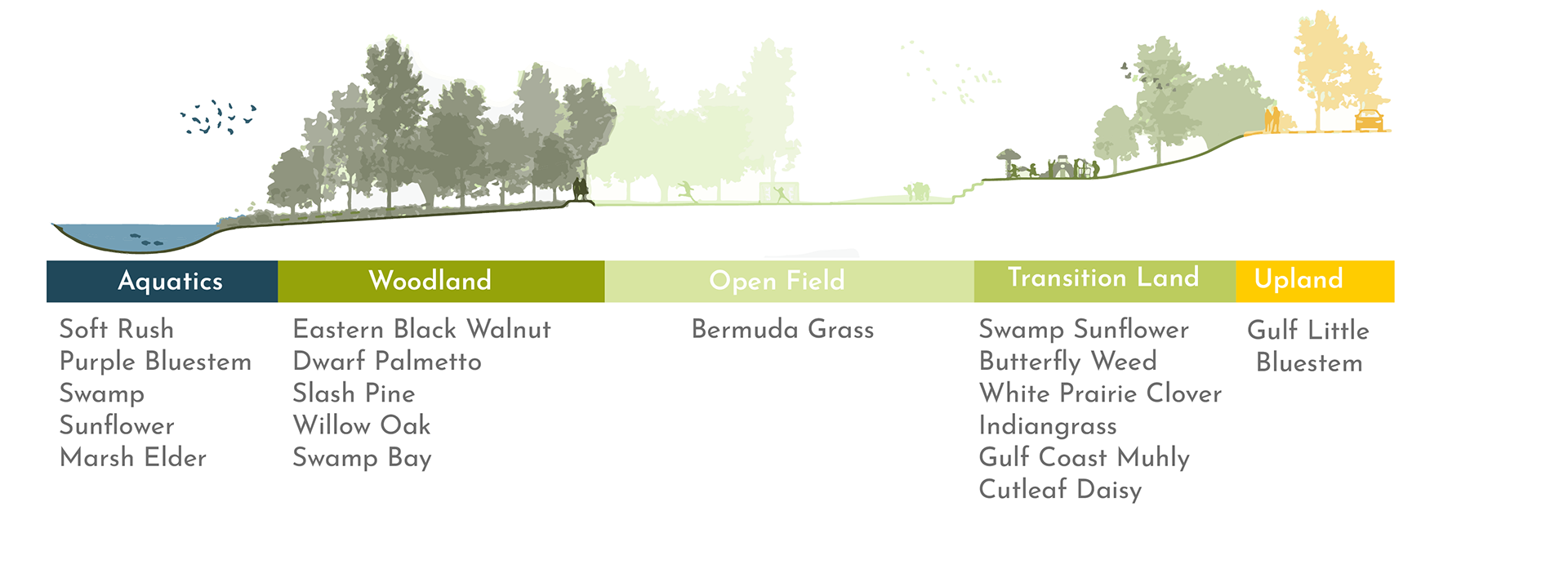
Almost 50 percent of the park consist of tree canopy, which can be used as a shaded trails. These are the types of trees that the team found in Hiller Park: Dwarf Palmetto, Eastern Black Walnut, Wax Myrtle, Slash Pine, Willow Oak, Live Oak, Yaupon Holly, Swamp Bay
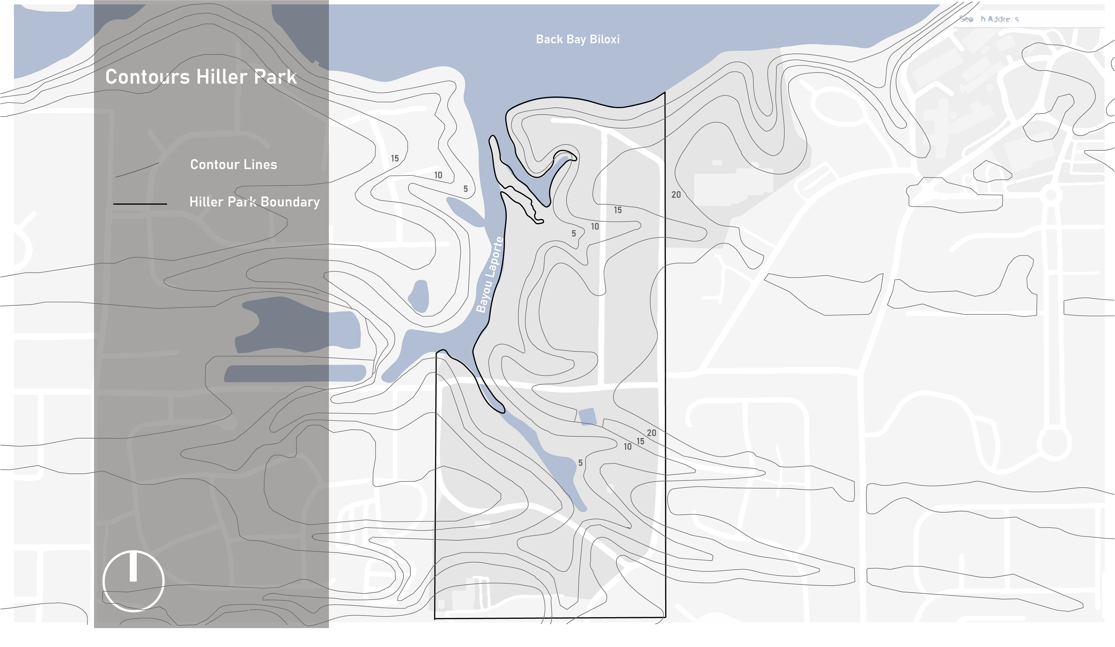
This map shows the 5-feet contour lines in Hiller Park. The topography slopes down from the neighborhood toward the water bodies.
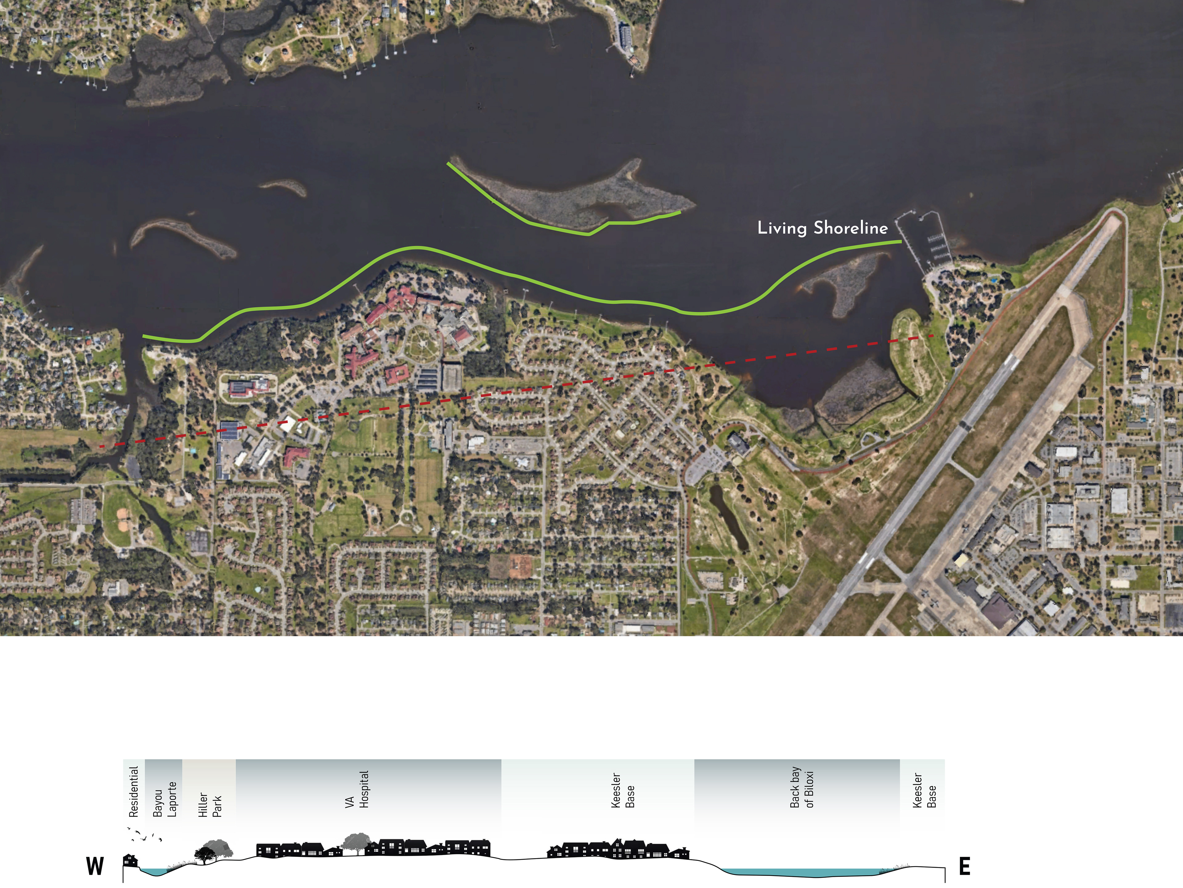
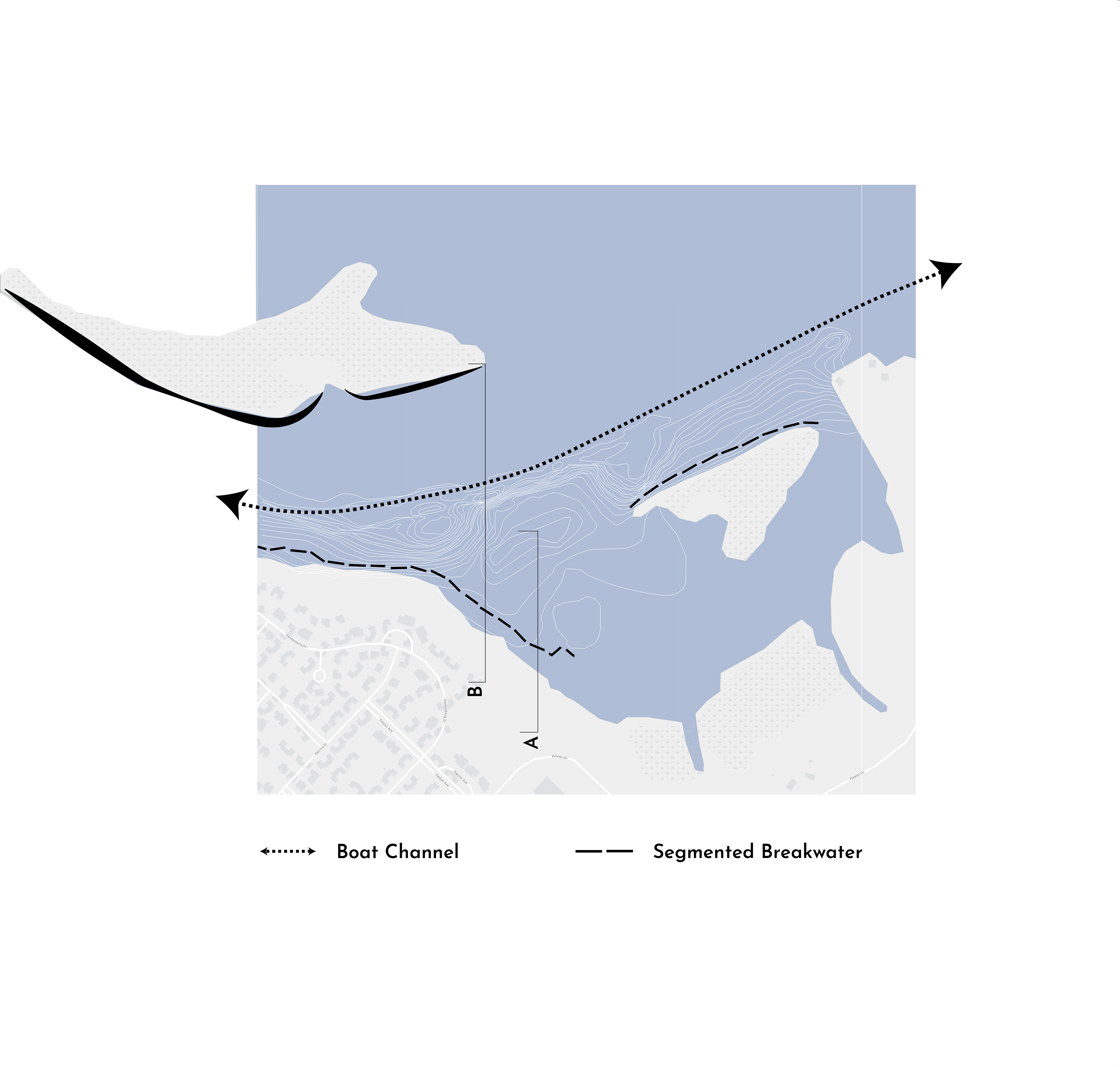
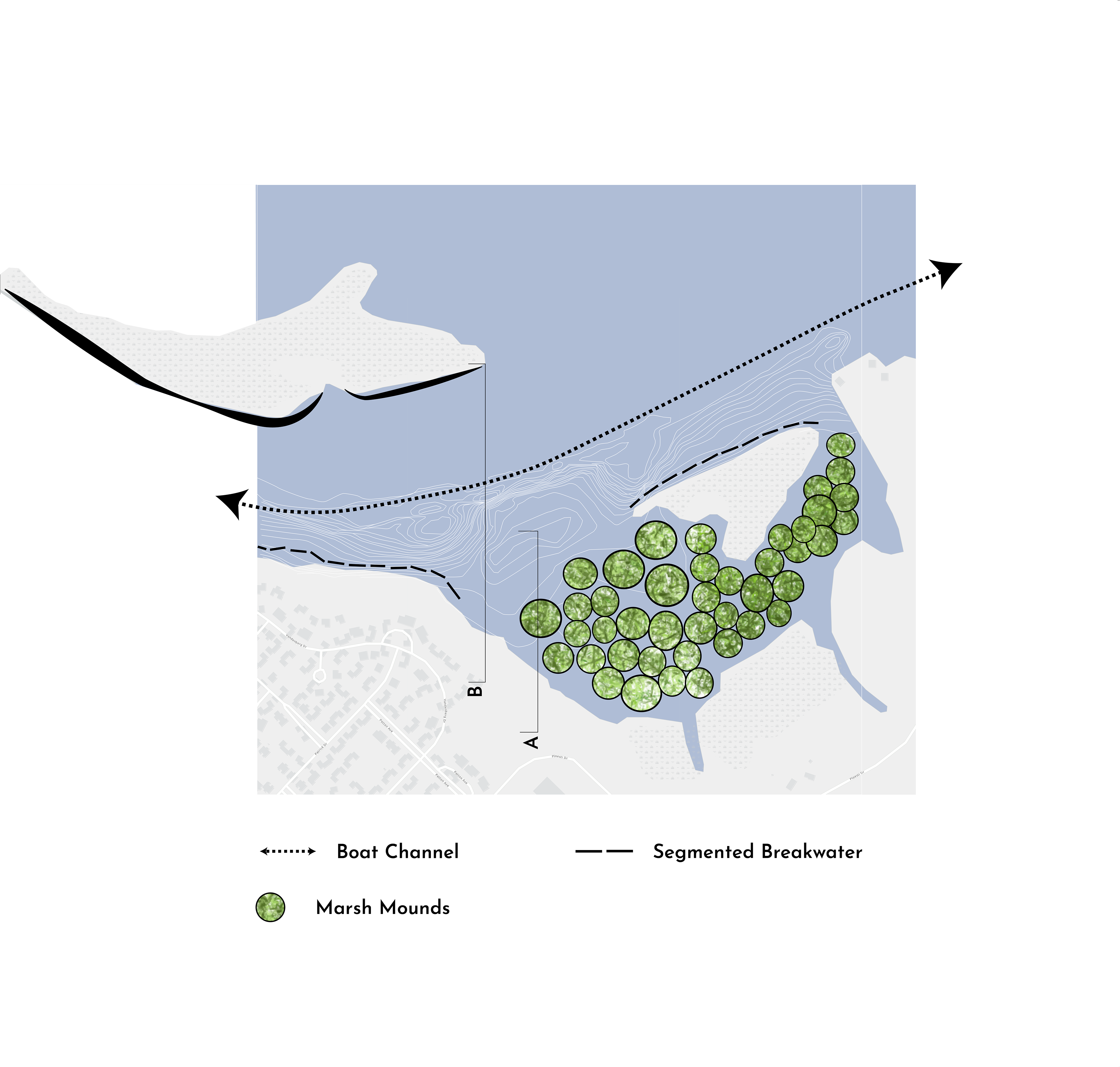
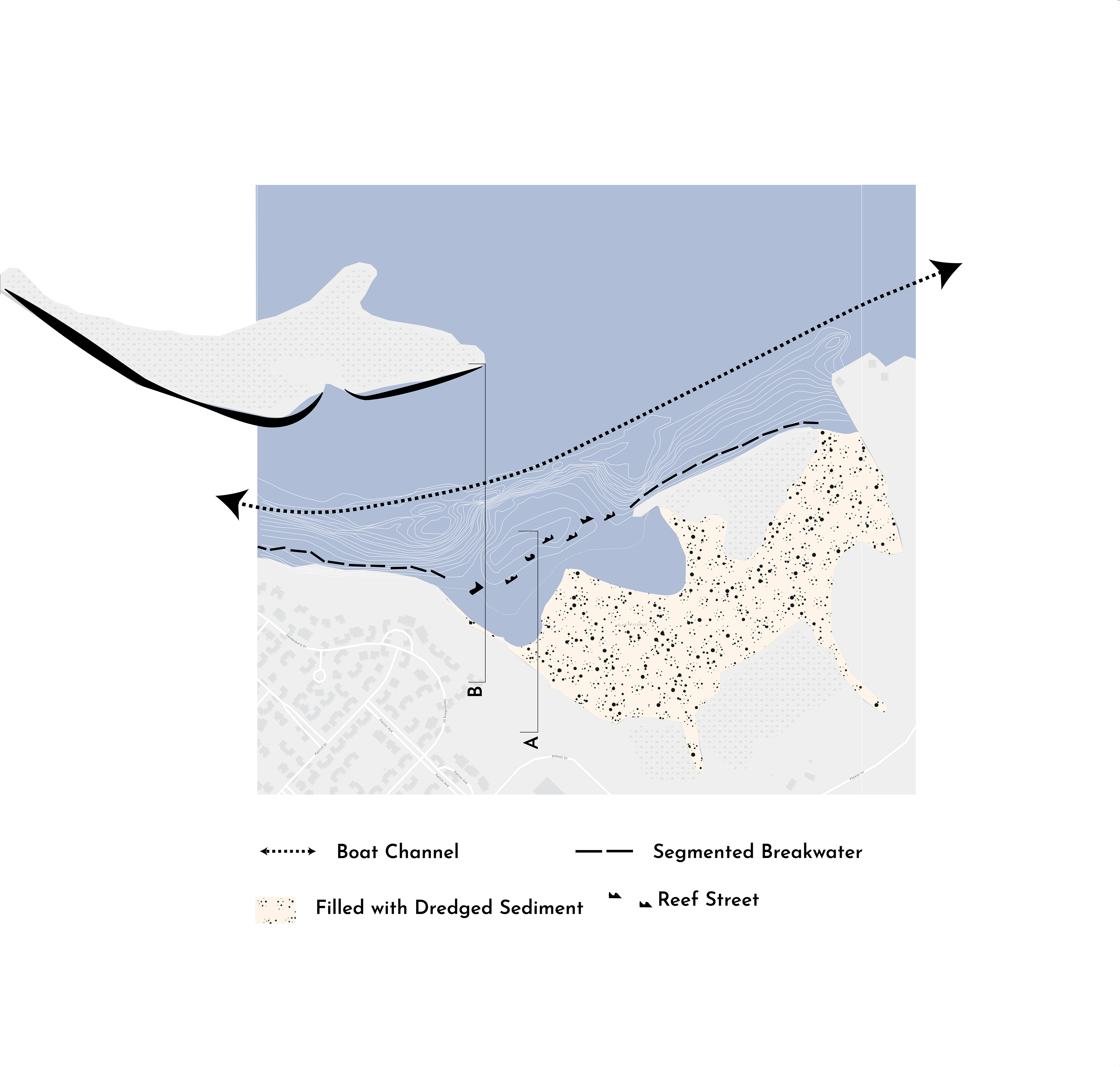
Shoreline Erosion – Keesler Air Force base and Hiller Park are both facing challenges with erosion that is caused by a boat channel that is close to their shorelines. The erosion on the shore will lead to marsh depletion, storm surge vulnerability, and loss of habitat at Keesler Air Force Base. Hiller Park has a problem with erosion on its shoreline as well, however, it also has the same problem due to stormwater runoff coming out of the pipes at a high velocity.


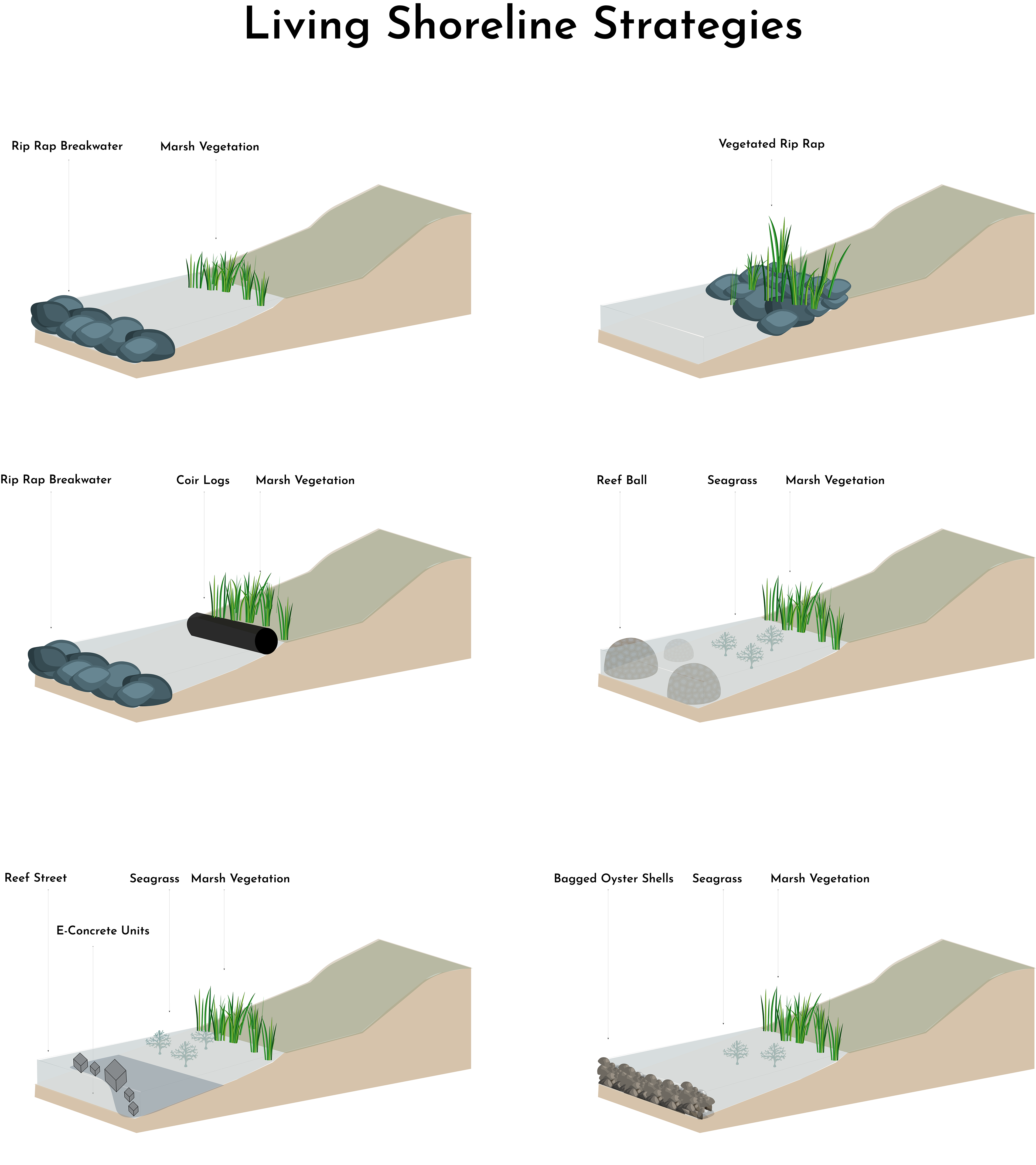
We studied the applicable living shoreline strategies. However, based on the soil type, salinity, erosion rate, slope, wave energy, water depth, and current shoreline type, we decided to combine some of the studied alternatives- breakwater streets with e-concrete units- to reach multiple benefits.
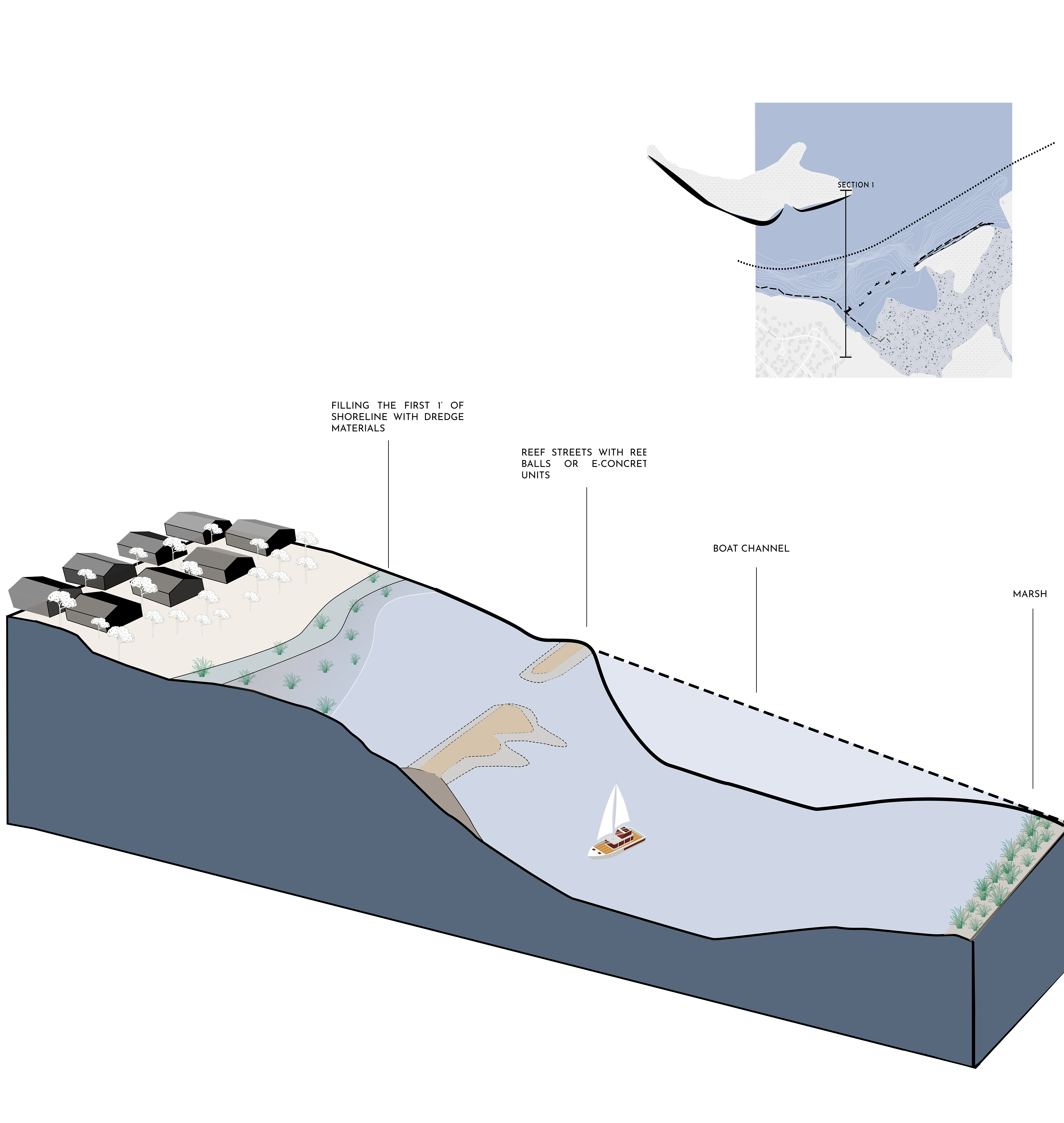
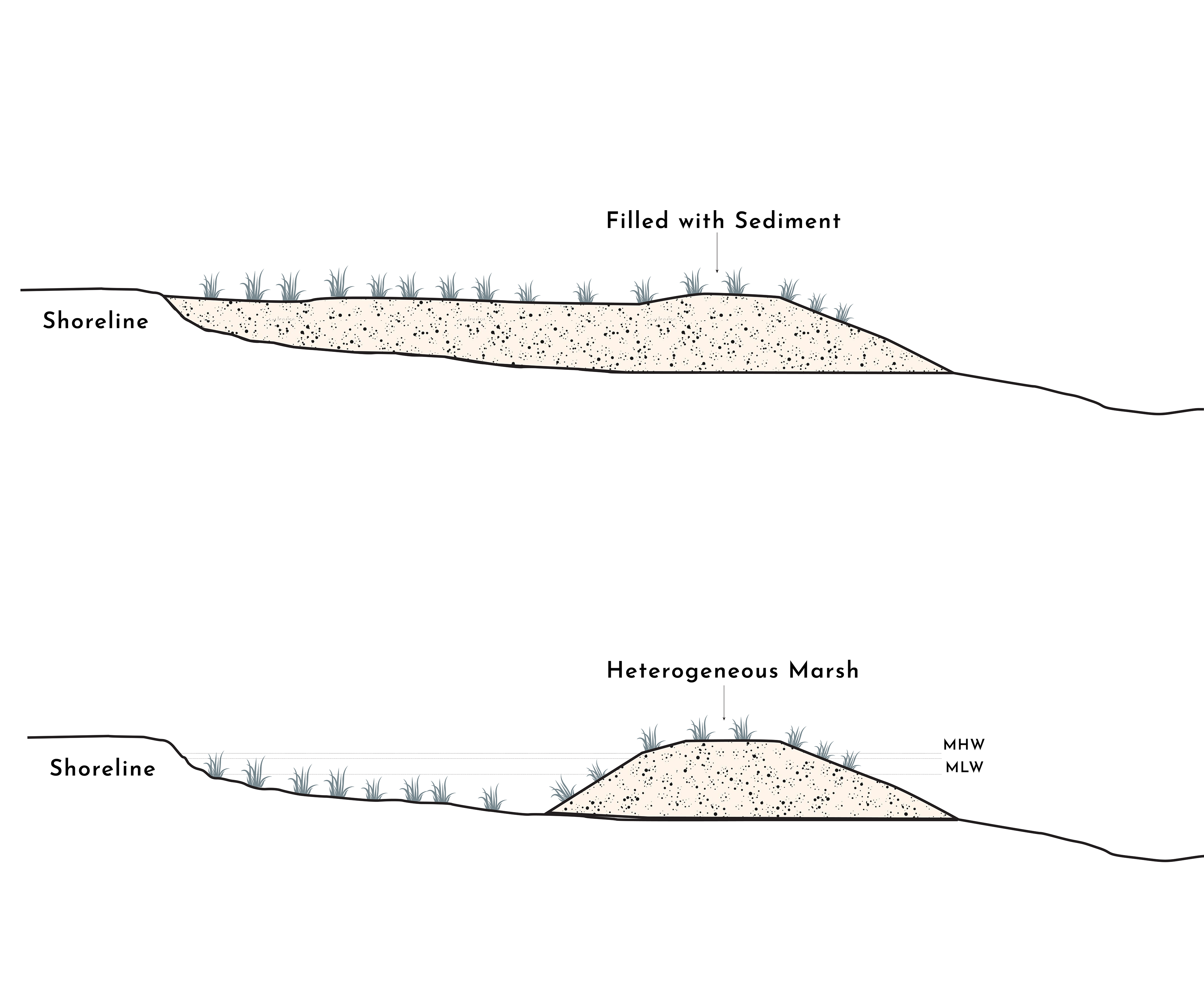
Moreover, since the shoreline in Keesler AFB (Area C), is shallow (1-2 ft) we suggest jump-starting with filling sediments from a nearby borrow area (Bayou Laporte or dredged materials from boat channel) and using that to fill the shallow area with sediments (Beneficial Use of Dredged material).
Section A
Proposed Living Shoreline by Mississippi State University
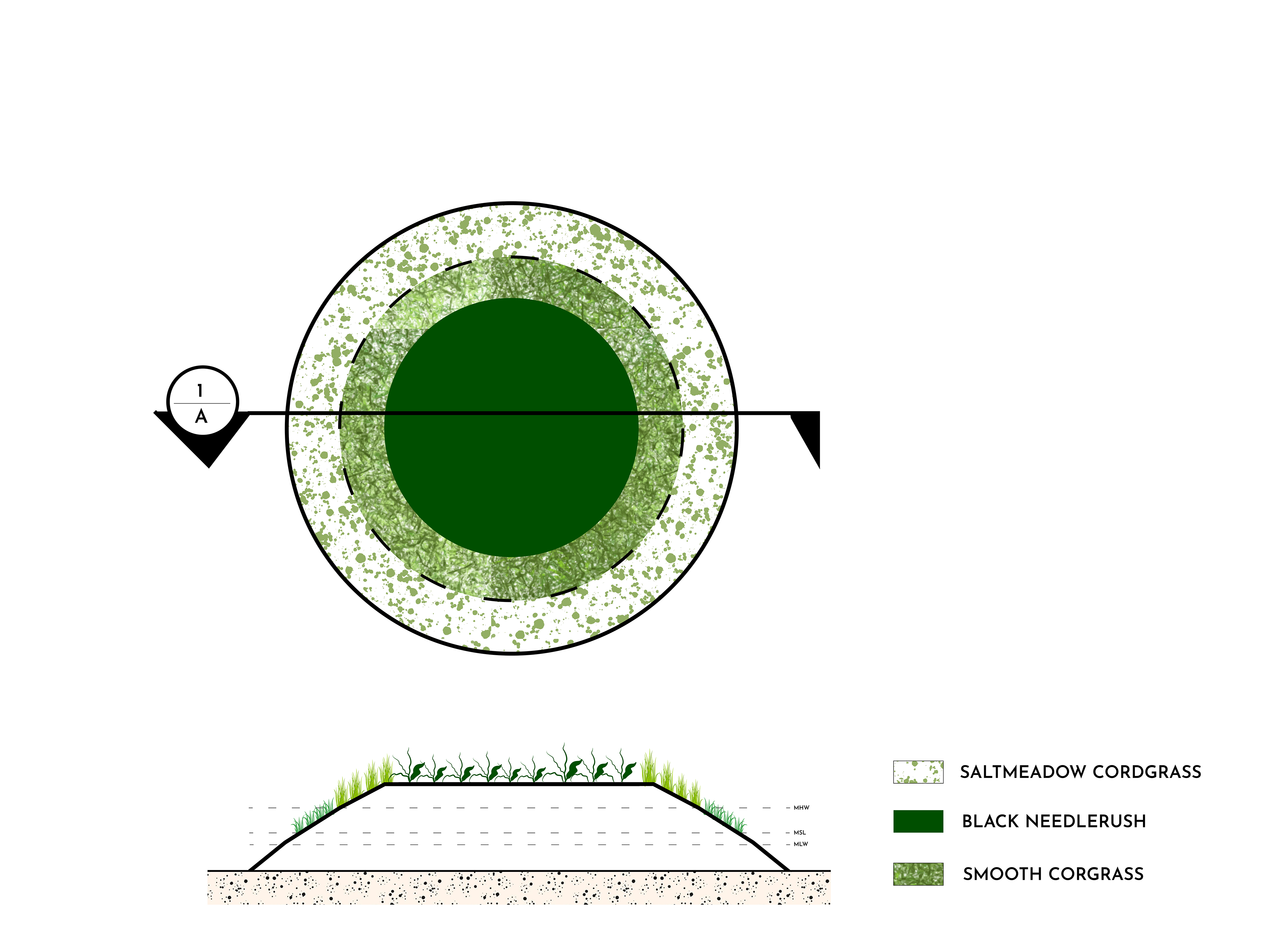
Marsh Mounds section
Our Second proposed Living Shoreline
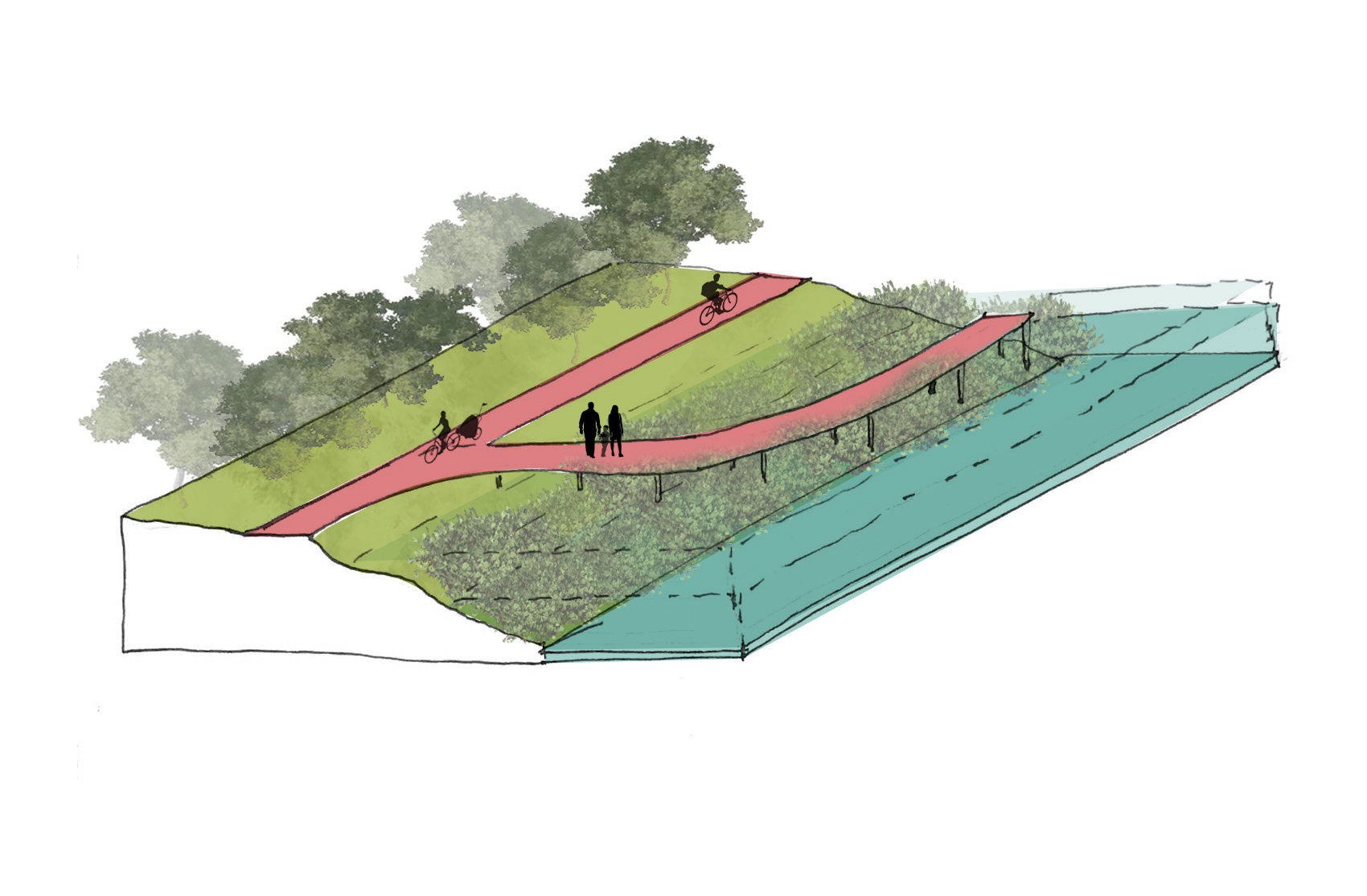
Design Intervention Section
Our first proposed Living Shoreline

Design Interventions